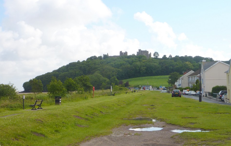
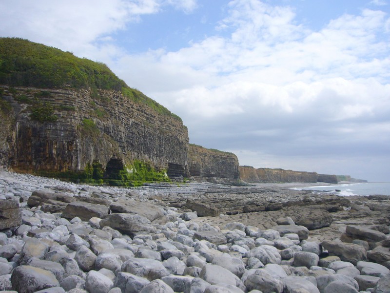
West and South Wales
Monday 4th July, 2011 More of the Welsh Coast
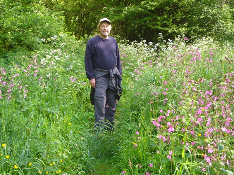
After a fabulous weekend at Ed & Liz’s in Abergavenny, with almost 40 of the ‘Cape Clan’, we set off to do some more of the Welsh Coast.
We finally left at about 11.00 am, having thought about Felix on his 11th birthday – well celebrated yesterday, which was Emma’s birthday, with a ‘Renee cake’ for all!
It had been lovely weather all weekend, and was beautiful today.
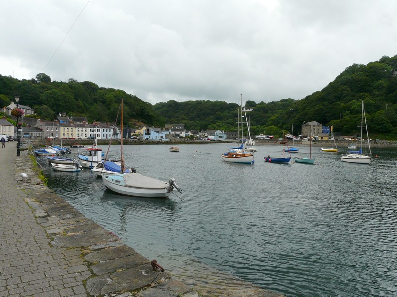
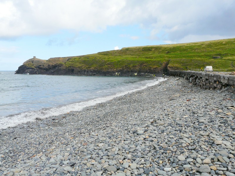
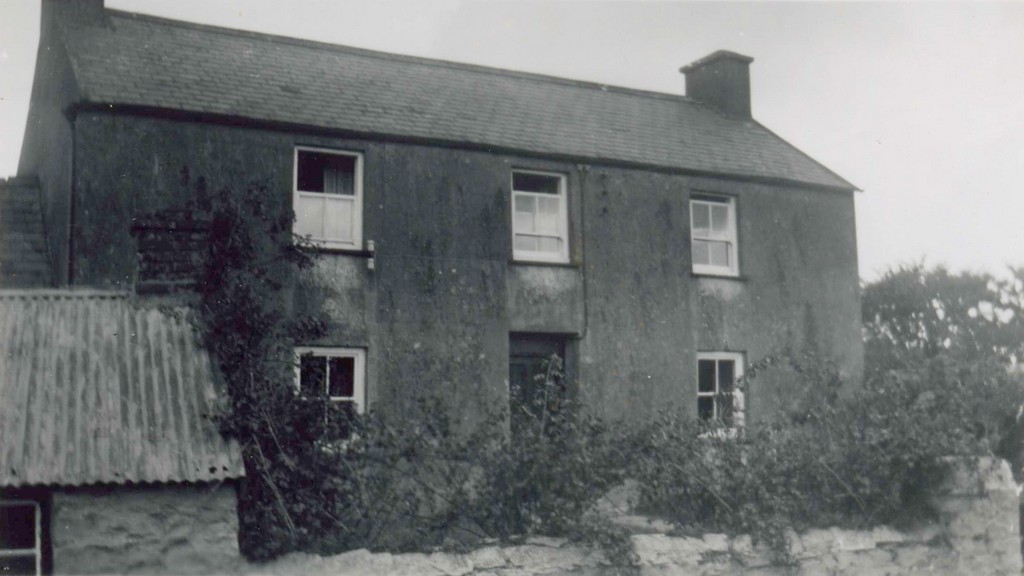
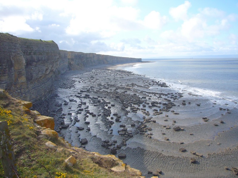
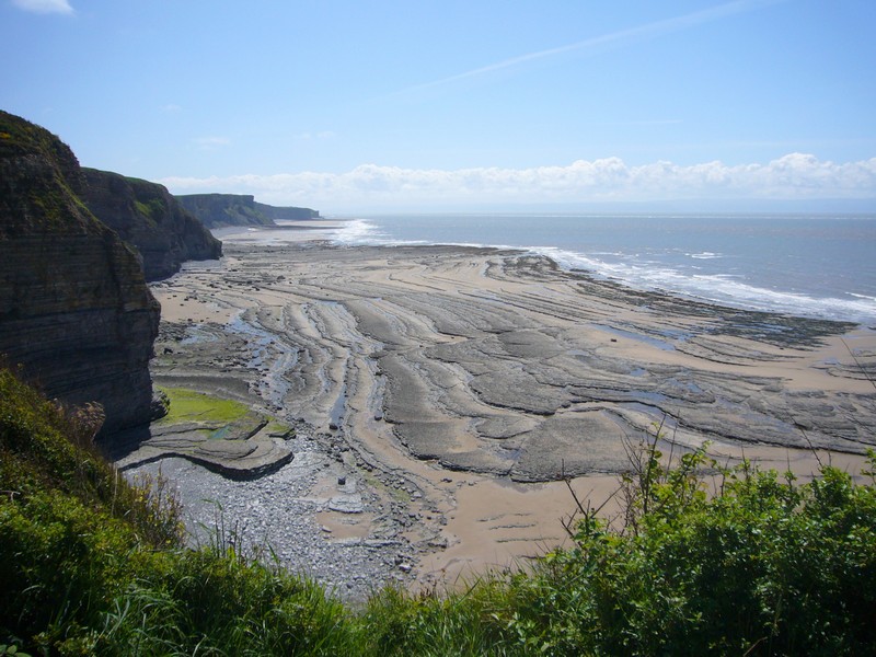
Our first port of call was Aberdare, where we located the birthplace of Mum Cape – a house much modernized, but neighbouring houses showed more what it would have been like. After a ‘photo shoot’, we left towards Port Talbot, looking out for a spot to stop for lunch.

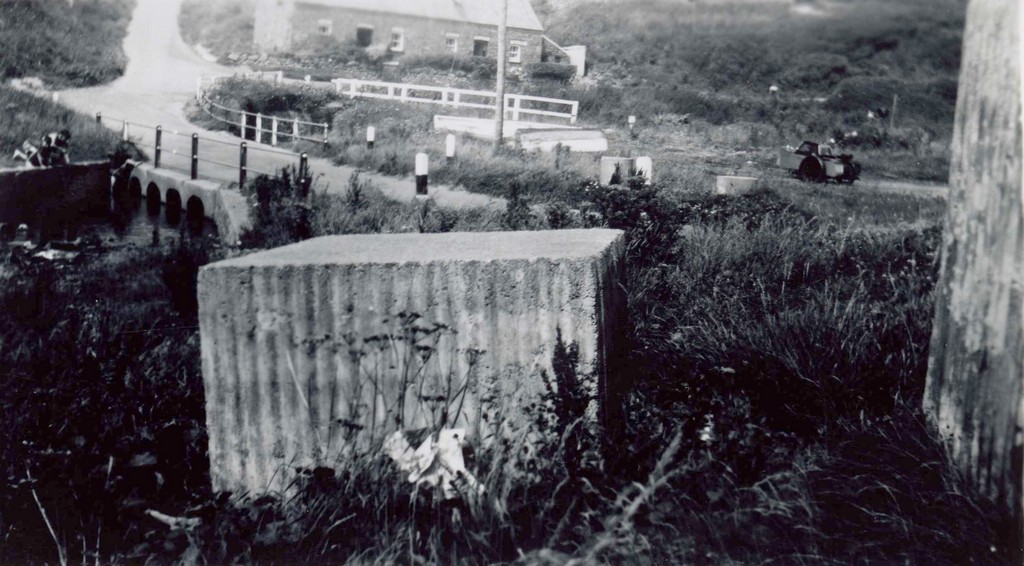
Nothing showed itself, so at Resolven, we turned off to a sign saying ‘canal’ and realized immediately that we had pulled into the same parking area when we passed this way travelling to Ed’s 3 years ago, after doing some of the coast of South Wales.
We ate lunch at a picnic table, with the River Neath below us. The sun was really hot. Before setting off, we had a change of plan. We had intended continuing west from Port Talbot, but now thought it better to carry on from Cardigan, which we had reached just over a month ago from the north.
The journey there, seemed to take a long time, and necessitated getting fuel from a motorway service area, which tried Adrian’s patience as we tried to follow the signs to the fuel pumps, and ended up going round & round.
It then didn’t help that we took the wrong road after leaving Carmarthen, but as we remember from the previous time, the last part of the journey, beside the River Teifi, was very pretty.
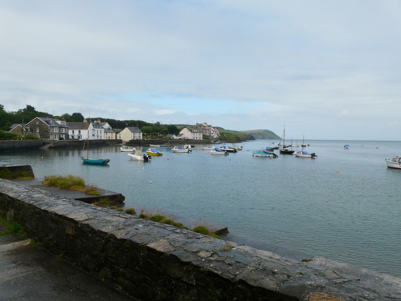
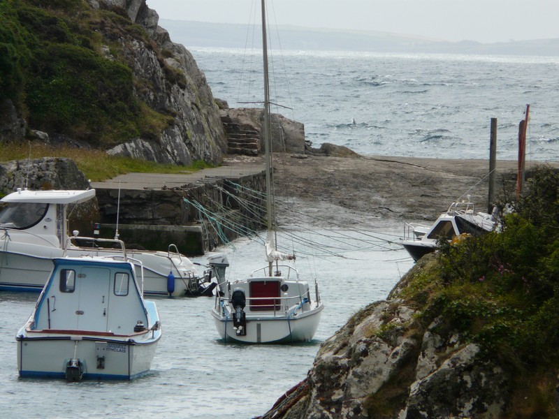
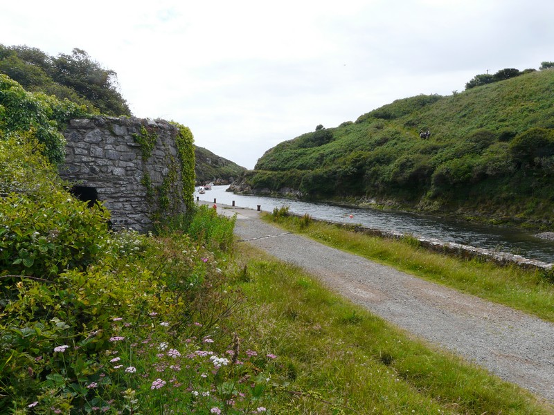
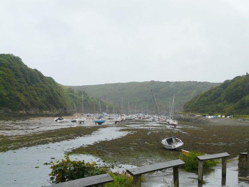
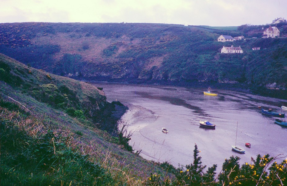
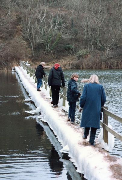
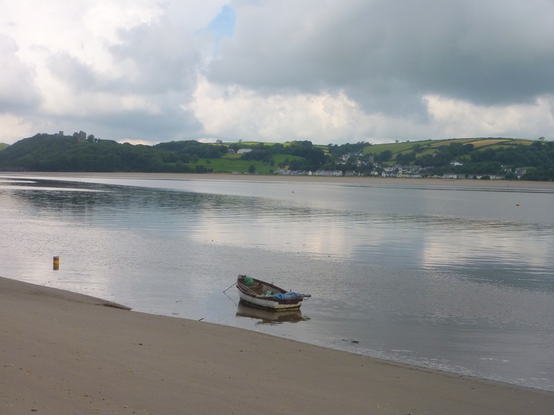
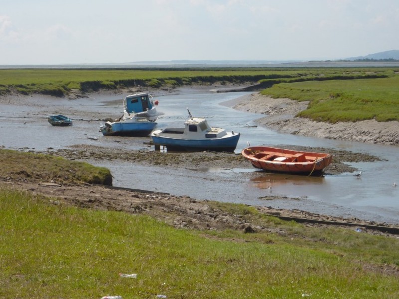
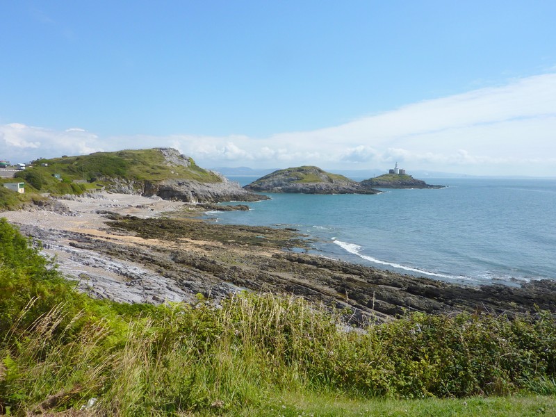
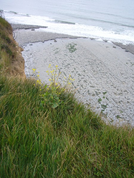
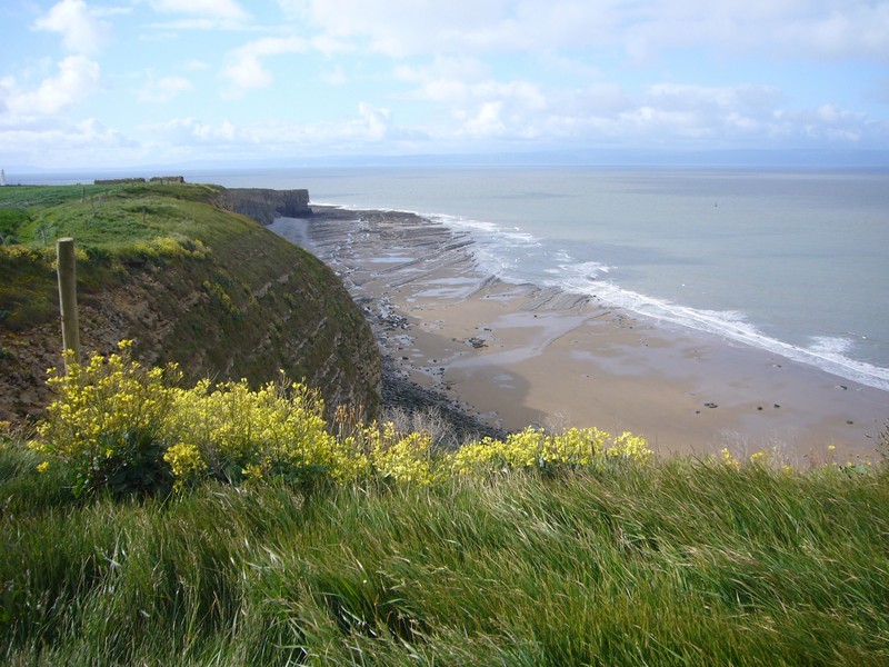
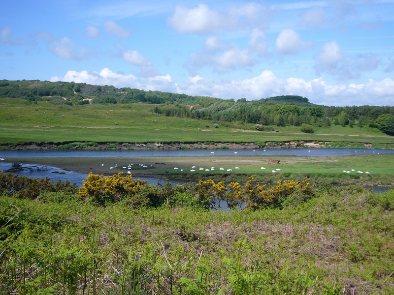
At Cardigan, we took the road to the west of the River Teifi, pulling in near St Dogmaels at a really pleasant grassy spot beside the river, with seats and a statue and views of the muddy estuary with its scattering of small boats. It was a lovely spot, and the start of the 300km Pembrokeshire Coastal Path.
We stopped again a bit further on at Manian Fawr on a rough area opposite a pub – what a nice location! We looked across the mudflats to the estuary.
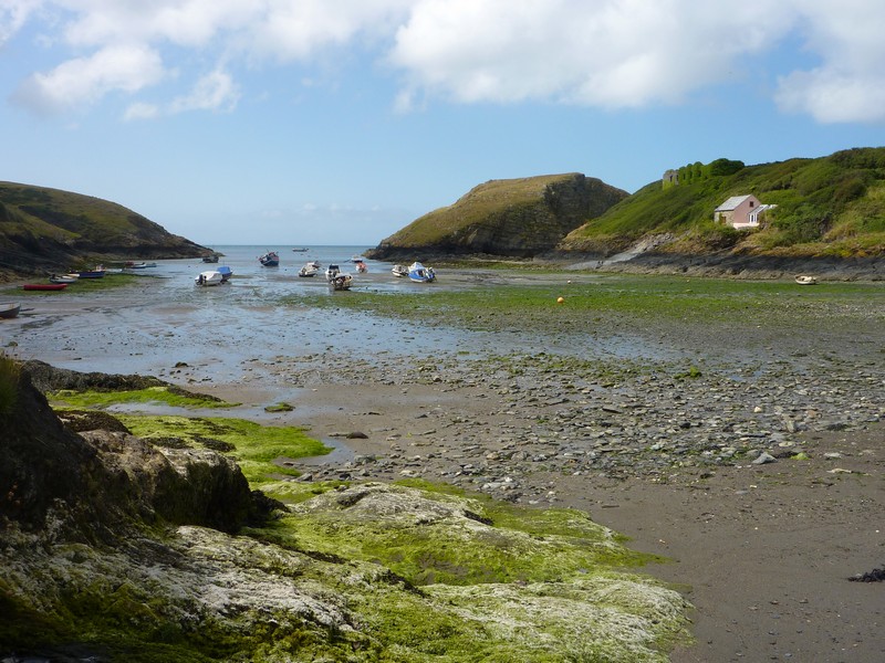
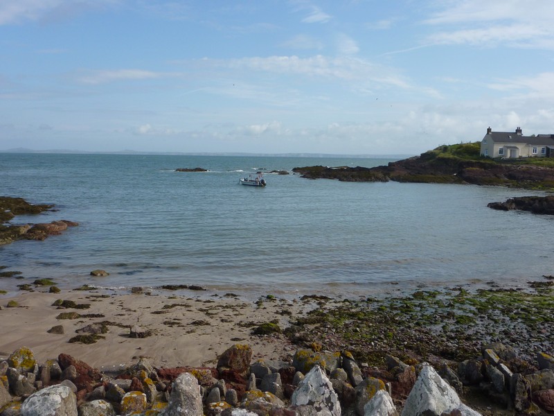
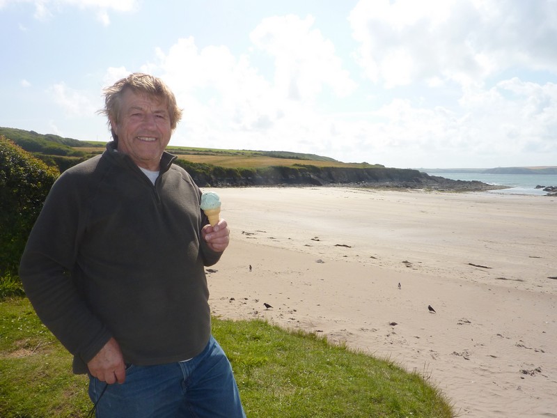
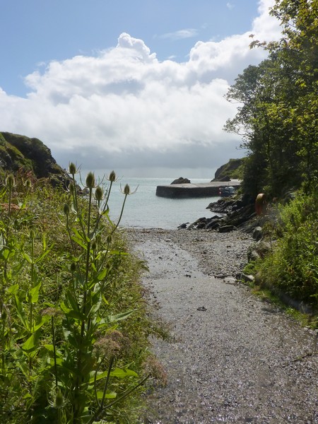
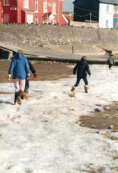
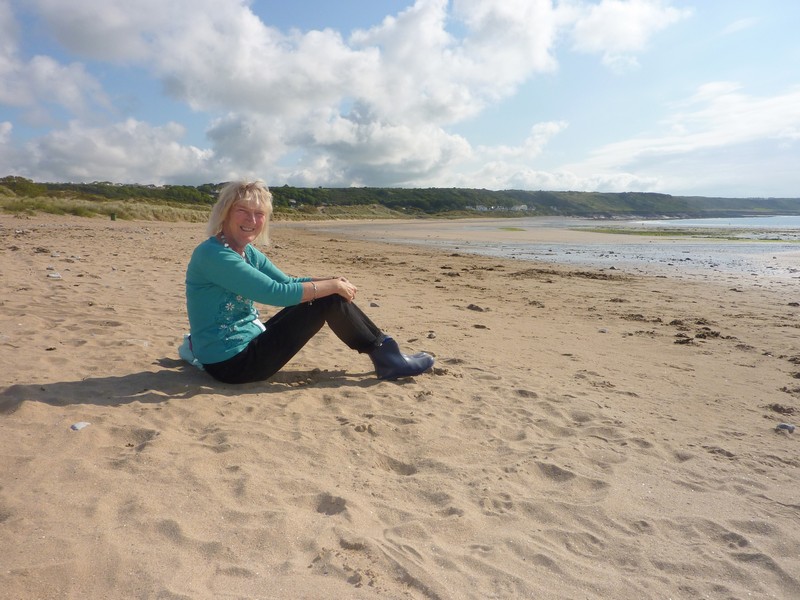
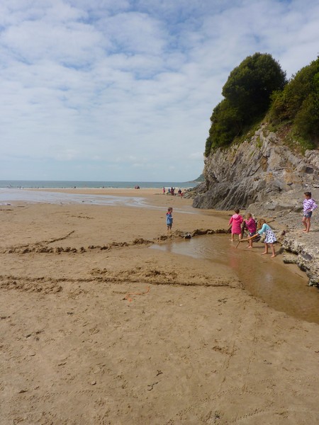
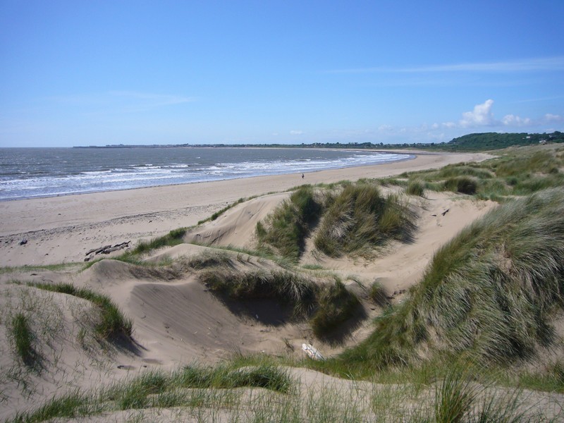
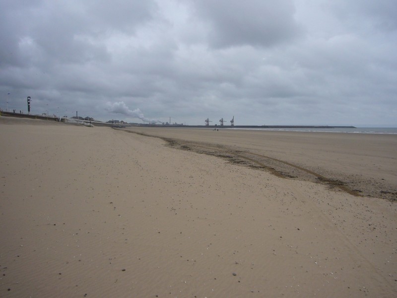
We then came to Poppit Sands, at the end of the estuary. What a pleasant surprise this was! Unlike the opposite side of the estuary, which just ended in an unattractive static caravan park, with nowhere for us to stop or pull in, this side had a large car park, an unobtrusive café, and a vast sandy beach. I’m sure that the car park would soon be full on busy days – it was quite full today. Being now 4.30, we thought it time to enjoy an icecream – even if the flavours didn’t tie up with those advertised – they were only for busy times!

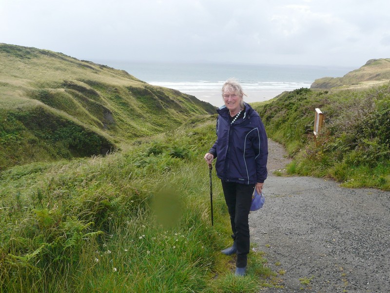
Rosie outside Mum Cape's birthplace, Aberdare
The start of the Pembrokeshire Coastal Path, St Dogmaels
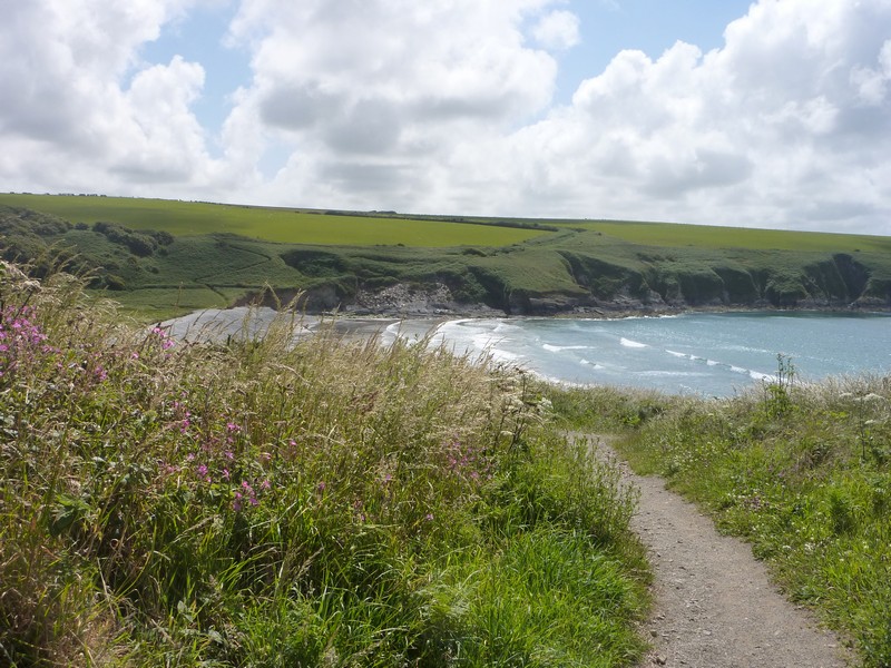
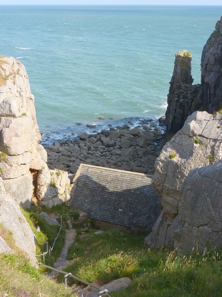
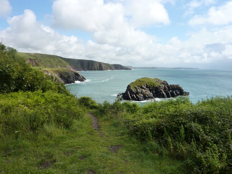
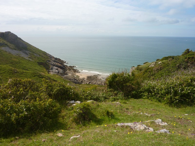
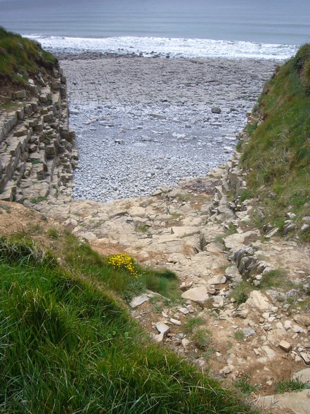
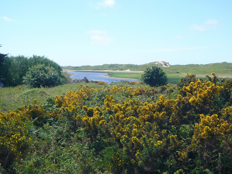
We walked across to the massive beach, where the tide was way out. Groups of people were dotted on the sand. We joined them for a few minutes before continuing on a narrow road to Moylgrove, with wonderful views of the superb coat southwards. We turned off on a minor road, luckily now surfaced, to Ceibwr Bay. The road descended a very long way, until we reached a place where you could pull off, very close to the sea. Adrian’s ‘Freebie club’ had suggested this as a place to stay, and what a top place!
Now 5.45, we walked across the grassy National Trust ‘cwm’ to view the spectacular dark, rocky, indented coast. We saw and heard oystercatchers land on the shaggy rocks, and watched a group of birds which we thought were linnets. It was still warm, though a bit hazy by now, and quite idyllic!
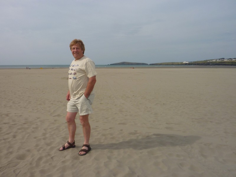
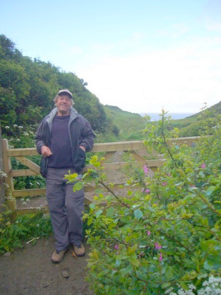
Adrian at Poppit Sands
We returned to the van in this absolutely unspoilt location to have supper.
After supper we walked out again to enjoy the view. It stayed light for a long time. It was interesting to see the different colours with the sea looking lighter as the sky darkened.
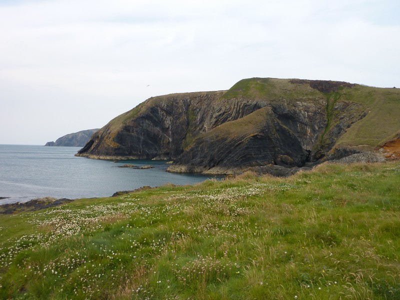
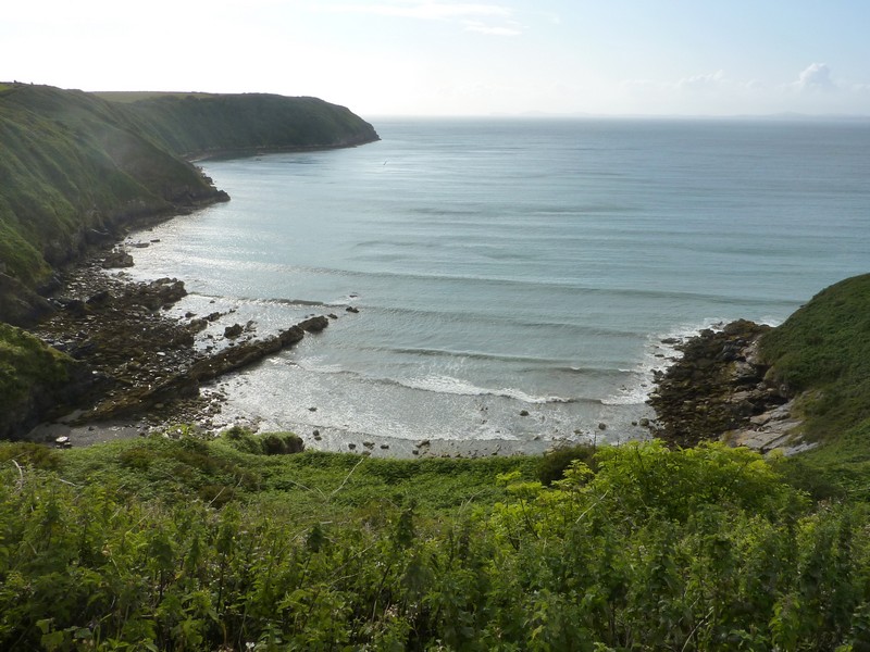
Ceibwr Bay - top overnight spot
Tuesday 5th July 39 miles
I was awoken by the wind blowing gustily in the night, and by morning it was raining heavily. We were glad to have had a second walk out last night.
We had no phone or radio connection here, so couldn’t listen to the last few days of Johnny Saunders with Chris Evans, but instead listened to our own music on the ipod.
We enjoyed breakfast with our lovely view and left just after 9 o’clock. At the top of the hill we got a phone connection, and received email messages from Simon (back in France) and Tom (just off to Jordan). We then put the radio on briefly, and heard the normally vibrant Archbishop of York, who is recovering after being desperately ill with appendicitis, but still did his ‘pause for thought’.
We drove to the end of the road overlooking Newport Bay from the east. We looked across to Parrog, and thought of Paul & Nicky, who had holidayed there earlier this year. The view as we drove down was lovely, but would have been spectacular in fine weather.
We drove back up the hill, and through Newport – a pretty little village, called ‘enchanting’ in our 1970’s book. We turned off to Parrog, a charming little place beside the water. While here, the weather brightened, and we walked around the bay on a footpath - there was no road. Access to the few houses was by a tiny road from the top - not wide enough for our vehicle. There was a pleasant campsite in a field by the sea.
We sat on a wall beside the water, which was wonderful, even if it did try to rain again! We thought this a top spot! Beaut!
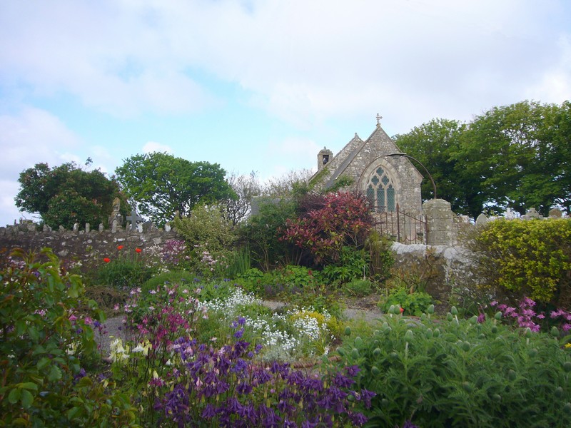
We drove back to the main road, turning off to Cwm yr Eglwys on a long and narrow road. This was a wonderful place, but unfortunately had nowhere to park. The nearby car park was £2 minimum. The beautiful coastline was enriched by the evocative sight of the end wall of an ancient church – the rest had been destroyed by a storm in 1859.I thought that it looked vaguely familiar, and on looking up our diaries later, found that we had been here about 30 years ago with the children.
We were on the eastern side of Dinas Head, and soon turned off to the western side, which we reached at Pwllgwaelod. This was a lovely sandy bay, and we could look across to Fishguard. We had a quick blowy walk on the damp sandy beach.
On our way back to the main road, by a different road we had to wait while the coalman finished chatting to a man he had been delivering coal to. The genial looking man had an oval head with a woolly hat on top – he looked like an egg with a cosy on!
We now drove on towards Fishguard, stopping to look out from a viewpoint where we could see across to the ferry terminal for Ireland at Goodwick.
The part of Fishguard called Lower Town is quite delightful. Pretty cottages fringe the attractive harbour with a cobbled road in front. We felt like intruders as we drove along in front of the houses. Old fashioned looking lampposts were bedecked with flowers. As our book said, it was like Brittany or Cornwall – we thought of Honfleur.
We navigated the narrow roads, and made for nearby Goodwick, stopping to have lunch in the carpark overlooking the bay, and eating French bread which Adrian had bought in the small Tesco.
We left at 2.45, and took narrow roads, which became even narrower after we turned off to Aber Mawr. We couldn’t turn round, so had to keep going. At the end of the road, there was nowhere to park, so we turned at the turning circle, and both had a quick view down to the lovely sandy bay. The name sounded familiar, which wasn’t surprising, as we discovered from the diaries that we had visited in the eighties.
The road continued to be extremely narrow, with grass growing down the middle, with high banks and overhanging trees. It was very pretty, but a bit hairy!
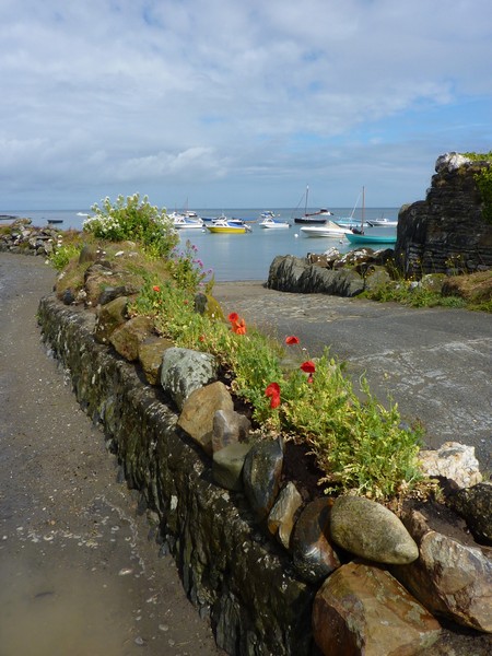
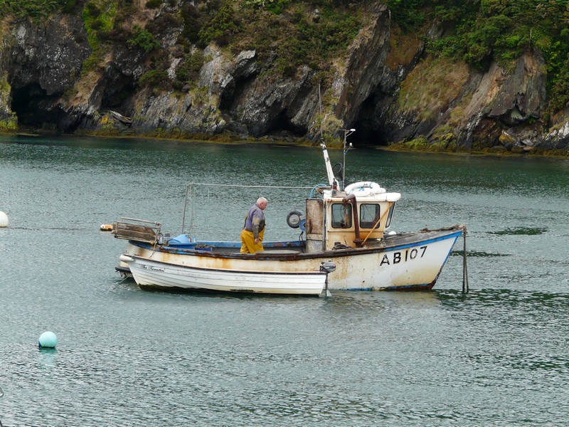
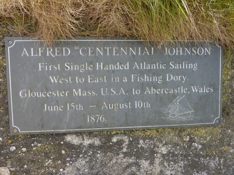
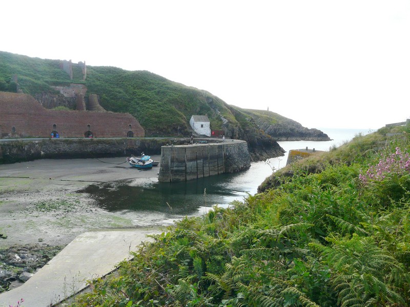
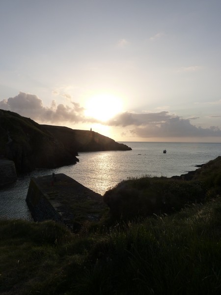
We now came to Abercastle, a typically pretty Welsh cove scattered with fishing boats. It was sunny as we walked on the sandy/shingly beach. We had been here before, too, we found out. With great difficulty, Adrian managed to get an internet connection, and we sent messages to ‘our 4’, and to Ed & Liz. We saw linnets or redpolls here too, coming down to drink from the stream. There was a marker to the first man to sail the Atlantic single handed – in 1876 -, when he had landed here.
Now it was through the pretty village of Trevine and on to Porthgain, where we had note that you could stay overnight.
We knew that we had been here, and this time found it to be even more attractive. There is a lovely harbour, overlooked by the ruins of huge brick buildings which had formerly housed slate, rock crushing and brick making plants. There was also the Sloop Inn, which I knew that we had been to once.
We pulled in, overlooking the harbour, and later had a walk around this fascinating little place.
Pretty Parrog
Cwm yr Eglwys
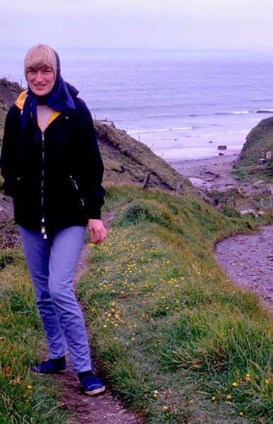
And as we saw it in 1983
Lower town Fishguard
Aber Mawr
Abercastle
We ate fish and chips for supper, bought from ‘The Shed’ – a small café housed in the restored stone brickworks building right by the harbour. We looked out to our superb view, and afterwards walked along to the viewpoint at the other side of the harbour, with views out to sea as the sun went down.
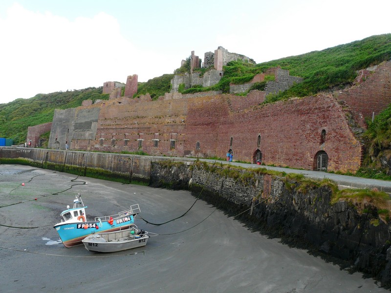
Porthgain
Wednesday 6th July 36 miles
Sun and sharp showers summed up today, although the afternoon shower was more than that! We left at 9 o’clock, by which time this busy little place was springing into action.
We made our way to Abereiddy, where we remember collecting fossils many years ago with the children. The tide was in, but by the parking area the beach was made of large flattish pebbles. We couldn’t see much evidence of the slate which we had found the fossils in.
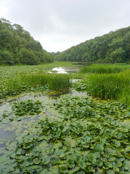
We knew that there was a pool in an old slate quarry, hidden from view. It got the better of us and we had to walk there, on a flat path, after some huge uneven steps. Since our visit of over 30 years ago, the importance of this little bay as a place of historic interest has increased. There were information boards by the ruins of the former dwellings which had housed the slate mine workers, and a trail around the area to the pool. Groups of divers were arriving and getting their gear on – it was obviously THE place to come.
We now drove on narrow roads to Whitesand Bay, on the western end of the St David’s promontory. This is the place to come to surf, so the large manned carpark is now fee paying, so not for us! We spent some time in driving along the neighbouring ‘no through roads’ for Adrian to try to locate spots where his family holiday photos had been taken in the fifties (didn't succeed!).

Abereiddy
We continued on more narrow roads with flower-filled high banks to the outskirts of St David’s, taking the road to St Justinian. On the way there, we came to a couple in a sports car. The lady was driving, and wouldn’t pass us, so reversed about ¼ mile, by which time there were four cars for us to manoeuvre past! The road just led to steps down to a lifeboat station, and a departure point for trips to Ramsay Island.
Whitesands Bay
There were just a few parking spaces, but we managed to find one (disabled), so we negotiated some of the steps. It was a very long way down, so we stopped by the information hut and enjoyed the view across to Ramsay Island. I would like to have visited, but the morning trip had left earlier, and the man said (unfortunately correctly) that the afternoon would become wet and windy!
We followed more narrow roads with banks full of flowers to Porthclais, where we pulled into a National Trust car park before walking across to the long steep sided inlet with its little collection of small boats. We had a short walk on both sides of the stream, wondering if it was here that we had a photo of on our previous visit many years ago.
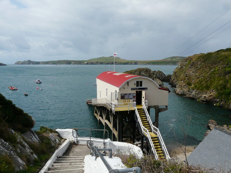
St Justinians - Lifeboat station and departure point for Ramsay Island
Now we had to drive back to St Davids, a really pleasant small ‘city’, but which we found incredibly busy. Finding nowhere to park, we had to give it a miss, just glimpsing the cathedral, but not able to photograph it to compare with before.
We drove on to Caerfai Bay, which again we had visited before. We were able to park overlooking the lovely coast, but it was a long steep walk down, so we decided against it. There were a lot of people about, some picnicking, but the weather was changing, and the sudden sharp shower sent everybody scurrying! We ate our lunch in the van, with very few people around us now!
When we reached Solva, it was raining hard, so we just stopped long enough to view the inlet with its few boats. With the tide out, and the weather bad, it didn’t have the magic that we remembered!
Porthclais - 2011 & 1982
Now on to Newgale, with its vast sandy beach. It was near here that we had stayed at Brandy Brook campsite 3 times in the late 70s, early 80s. With the reduced visibility, and the wind and the rain, only a smattering of windsurfers and kite surfers were braving the elements! It was lashing with rain as we pulled in opposite the pub which we had often frequented and watched them for a few minutes.
South of here is Nolton Haven, where Adrian had stayed twice for family holidays as a child. By now the rain was coming down in torrents – the road was flooded, and the windscreen had waves of water. We pulled into the car park, and as the visibility was almost nil, thought that we might as well have a cup of tea! We pitied all the people out walking.
Eventually it stopped raining, so we ventured out in our wellies to the beach.
Solva in the rain 2011
Solva 1967
Solva with the children 1982
We turned off to Druidston Haven. The narrow road here had been surfaced, and with the absence of high banks, was easier to negotiate.
It had always been difficult to find anywhere to park along the road, but now almost all of it had double yellow lines. A small section had been left clear, so we pulled in – nobody else was about right now! We walked to the start of the long trail down to the beach, and enjoyed the view.
We then drove through the village of Nolton to see if Adrian could locate the places where he had stayed.
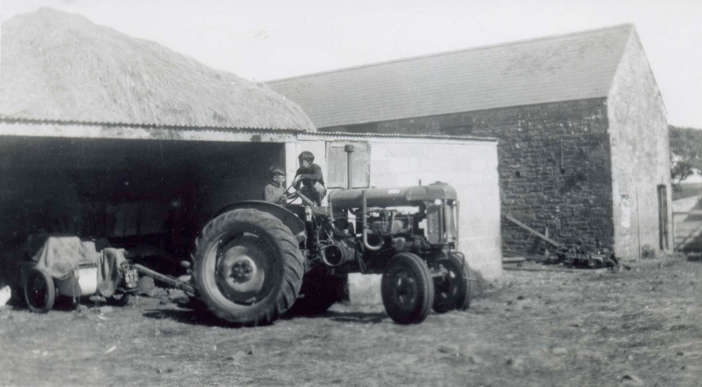
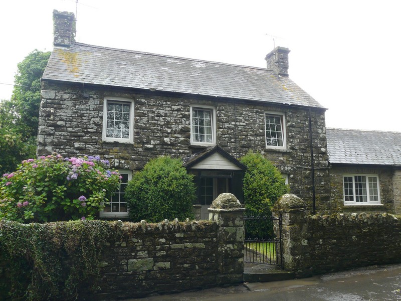
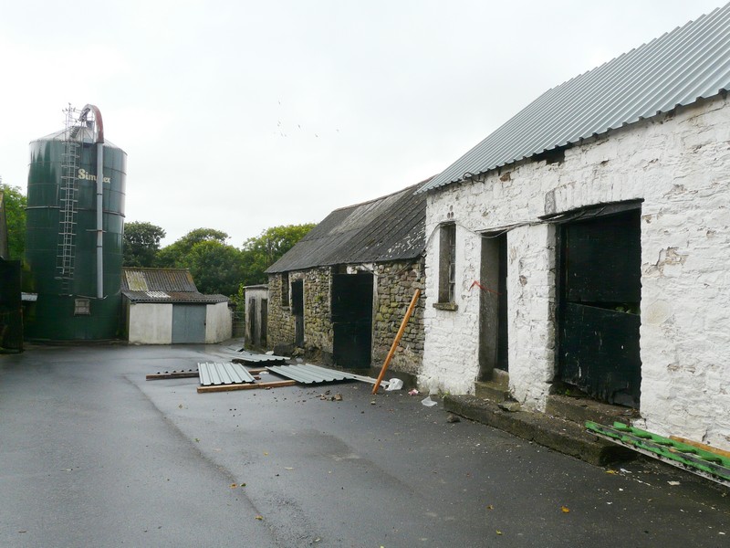
Nolton Haven 2011 and 1952
The farmhouse and farmyard (with Adrian "driving" the tractor) at Nolton, 2011 & 1952
We drove on past Broad Haven, with its lovely wide sandy beach. Adrian had note of a place to overnight here, and we turned off to a small carpark near the coast, which clearly stated ‘No Overnighting’. The car park he wanted was behind the pub, so didn’t suit us. However, from this first carpark, there was a boardwalk around a pond, which I decided to try. It was very pleasant, but I didn’t know how long it was, and also wondered if it was going to rain again (it had just stopped, and did in fact rain again just afterwards!) I actually met Adrian just before getting back to the van – he had come to locate the other carpark.
We drove on through pretty Little Haven, but as there was no easy parking we just had to view it and stay with our memories.
We continued on the road to Talbenny, and soon came to a pull off beside the road with a viewpoint to the Marloes peninsula. This seemed a good place to stop, so we pulled in. Amazingly the sky cleared to give a blue sky, although the weather was variable during the evening.
Rosie at the top of the track from Druidston Haven 2011 and 1967
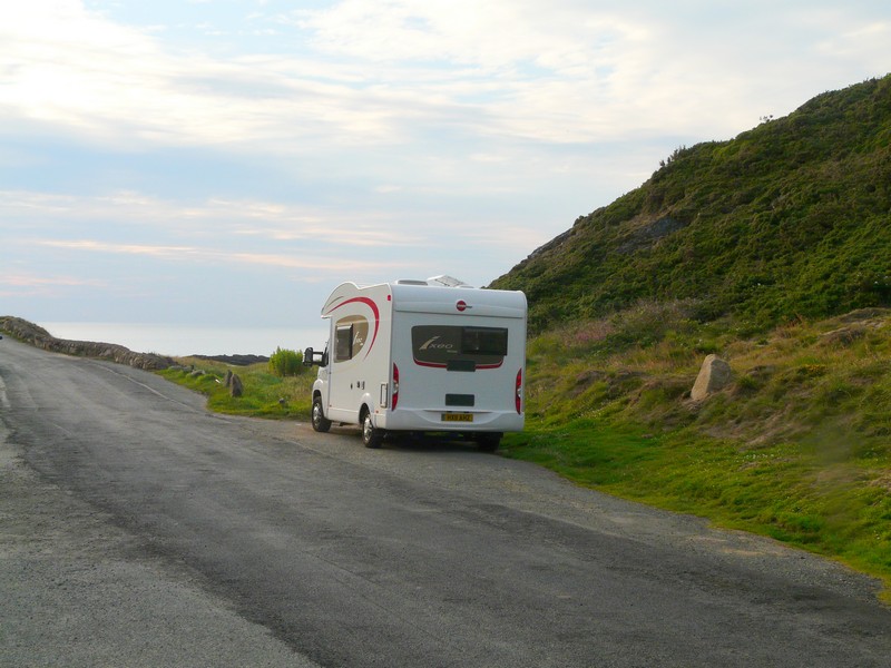
A good overnighter
Thursday 7th July 76 miles
The day was supposed to be one of sunshine and showers, but our showers were all before we left, and we had a pleasant, mostly sunny day, with a strong wind.
We left before 9 o’clock, and were surprised to find that we were yards from a road junction, and a static caravan park! We had wondered why several people had walked past last night, when we thought that we were in a really remote place!
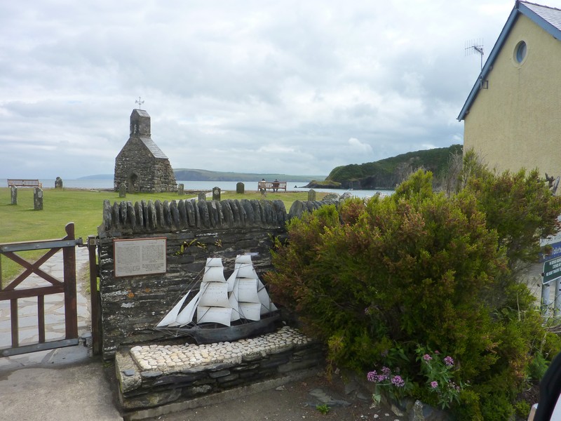
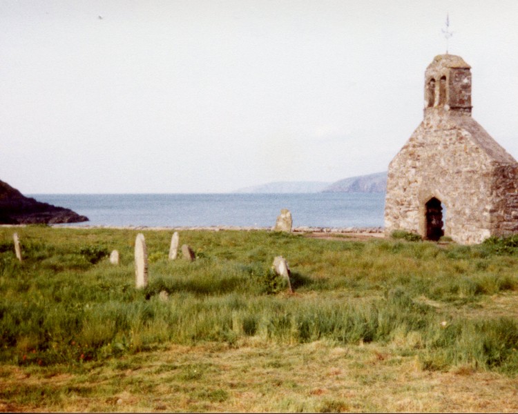
Our road took us past a disused airfield as we made our way to St Brides. This is one of the most delightful Welsh coves we have come across. The bay was of flat red rocks, with red sand, and overlooked by just one house. Behind it was the lovely stone church of St Brides. Up behind stood impressive St Brides Castle, which had been used as a sanatorium in the past, and is now smart holiday accommodation.
We now followed rural roads towards Marloes, an expanding small town where the charm of the old village could still be seen amongst the more modern, characterless dwellings.
We continued to Martin Haven, which is where the boat departs for Skomer Island. A boat was about to leave, and we would like to have been on it, but realised that it would be difficult for me to cope with a place where walking is the only real option. We watched as other passengers descended the long path and steps to the boat, remembering our idyllic trip to the island in 1983. I had thought then that it was paradise.
We now drove back through Marloes, stopping to buy a small bag of new potatoes from a farm. They seemed to be expensive, so we hope that they are good!
We found our way to the car park for Marloes Sands, on the southern side of this peninsula. It was a National Trust car park, but we could see that it was too far to walk to the beach, so we didn’t stop, and took more narrow roads towards Dale. This little waterside town is supposed to be the sunniest place in Wales – the sun certainly shone while we were there. We had pulled in by the water’s edge just before Dale, overlooking the stretch of water called Dale Roads, part of the long, almost enclosed, Milford Haven. On our return we stopped to look at one of the many lime kilns which are prolific in this area.
We drove on through Dale to St Ann’s Head, at the southern point of this peninsula, and at the western end of Milford Haven. There was a National Trust carpark here too, but we decided to keep our walking for other places, and sufficed with the views to Skokolm and Skomer.
We drove the couple of miles back to Dale, and after negotiating its one way system around the village, and past the ugly church with its elongated concrete tower, we found the road to Dale Point. This road took a lot of negotiating! To start with, Adrian had to squeeze between houses with hardly enough room for a car, let alone a van, and after that, the road was just wide enough to drive along, with no passing places at all. We drove through the wooded slopes beside the water for nearly a mile, until we reached the Field Centre, where we turned round, passing the lone walker again on the way back, but thankfully no other vehicles!
Then it was round the one way system again at Dale, before heading for St Ishmaels, which we drove through/around and on to a road to Sandy Haven, on another inlet of Milford Haven. Unfortunately, a sign at the beginning of the road said ‘no turning places’, so we didn’t dare risk it, and just photographed yet another atmospheric lime kiln at the road junction.
St. Brides
We drove on around the inlet to the town of Milford Haven, turning off just as we reached it to Gelliswick Bay. The beach here was of mostly pinky red pebbles, but it was pleasant enough to stop for lunch. There is now far more evidence of the oil refineries than our 1970s book and OS maps suggest!
Milford Haven itself was nice enough, with flowers and seats along the front. We very quickly found ourselves out of the urbanisation – at Black Bridge the B road crossed the inlet at a really pretty spot. We drove on past the oil refinery, reaching the water again at Llanstadwell The road went along beside the haven here, and was lined with attractive houses. Unfortunately the road was closed for roadworks, and we had to go on a diversion inland until we found our way back down to the water at Neyland.
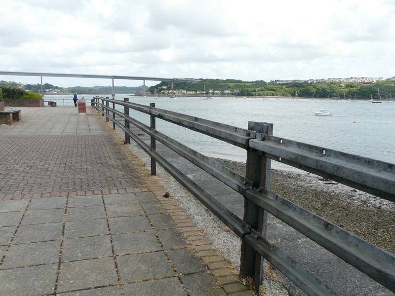
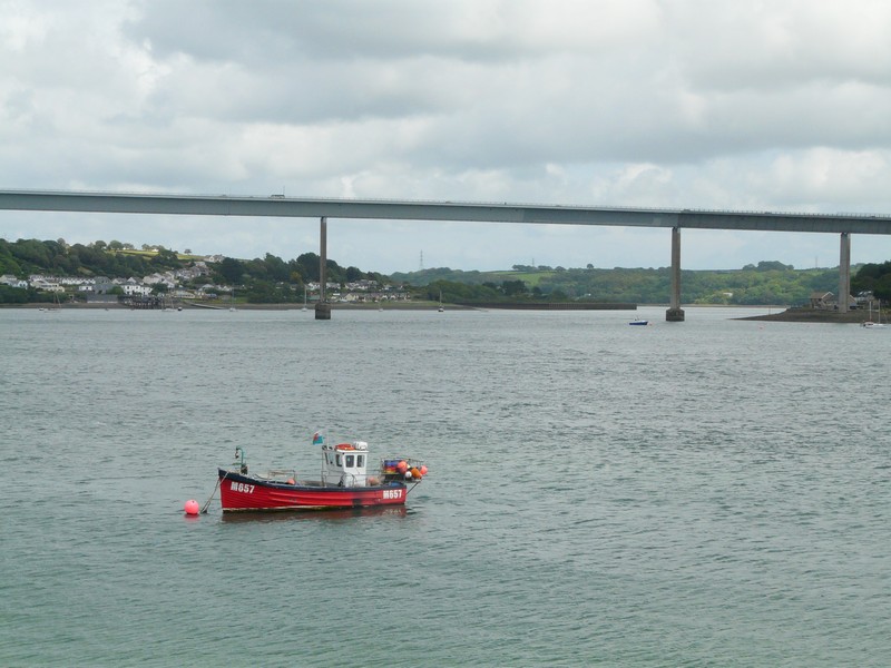
The ferry at Neyland has been superseded by the bridge built in the 70s (but not on our ancient maps or book!) The area at the front is now called Brunel Quay, with information boards about Brunel’s accomplishments. We walked around, with the bridge towering above us.
A lime kiln at Sandy Haven
The sun had made it really hot in the van, but the wind here was chill. As we’d arrived in Neyland, Adrian had said ‘I’m sure that we came here before, and I photographed a hexagonal post box.’ Sure enough, we saw an information board about it, and could see the actual post box nearby.
Brunel Quay with his 'broad gauge' rails - now a fence
The Neyland bridge, which replaced the ferry
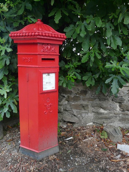
Victorian Postbox, Neyland
We now crossed on the ‘new’ bridge, coming to Pembroke Dock, where we got a bit lost, but did buy some inexpensive fuel from Tesco! We remembered coming here in 1991 to catch the boat to Ireland, and its delay due to terrible weather.
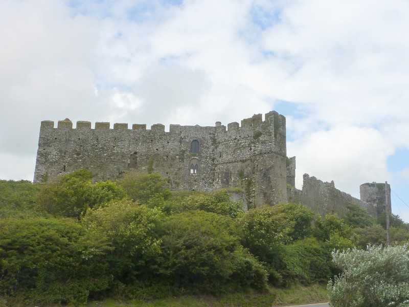
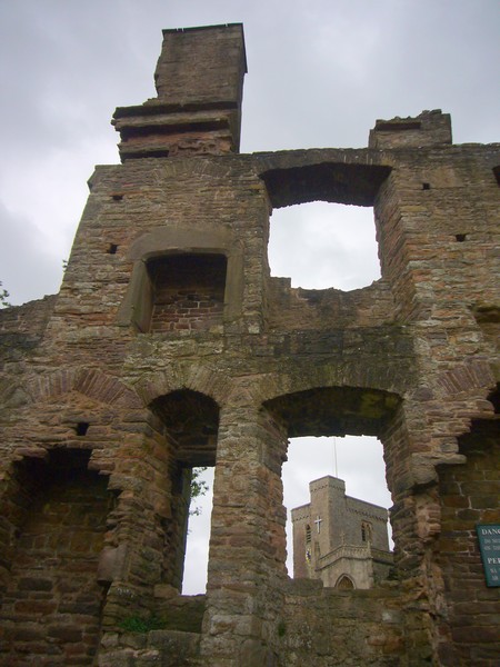
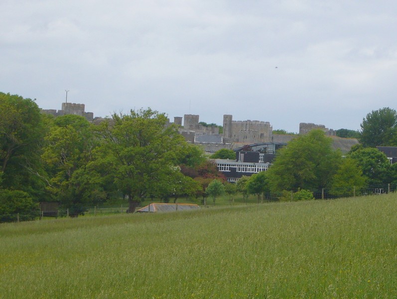
We drove on to Pembroke, stopping beside the impressive castle, and remembering our previous visit of 1982.
We had to negotiate the one way system through the attractive town of Pembroke, and after a bit of consternation, onto the road west to Angle. When we reached this, we couldn’t actually see Angle Bay, the part of Milford Haven which it is on. The ‘town’ is just one long road, but negotiating it was difficult because two road work vehicles left scarcely enough room to get through. We were really glad that there was a small bus in front of us!
Half a mile west of Angle, and on the other (sea) side of this headland, is West Angle Bay. What a wonderful surprise! A beautiful wide, sandy beach edged with a line of rocks. The tide was out, but we walked right across the beach to the water’s edge and back, deserving the ice cream which we had afterwards! The weather was windy, but sunny. We could look across to St Ann’s Head at the end of the ‘Dale’ peninsula.
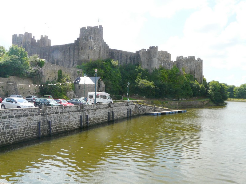
Pembroke Castle
The road south took us past Freshwater West, a lovely spot, with sand dunes and a huge sandy beach. Quite a lot of people were enjoying themselves here, but our book told us of strong currents (there was a very narrow patrolled area) and quicksands. Also, the land all around here is a Firing Range, and so closed to the public. In fact the main road was blocked off, which had us confused, as we had been following that!
We managed to find our way to Bosherton, driving past the pond area to St Govan’s to the south. Here there is St Govan’s chapel, set in amongst the rocks, a steep climb down uneven steps. We viewed from the top, and Adrian walked down to the chapel to photograph it.
While here, we received an email on the phone to say that Shirley Pippin, founder member of the HCC, and a real character, had died.
Saddened by this news, we made our way to another ‘Broad Haven’, referred to as Broad Haven South. The NT car park here was busy, but when we viewed the beach, we could see why – it was a beautiful sandy cove, and would appear to be sheltered from the wind today. People were all just making the long trail up from the beach at the end of the day.
We needed somewhere to stop for the night. We had seen a little campsite back at Bosherston. We made our way there, and while parked in the lane, a young chap on a tractor drove past and said that it was £4 a night. Great, we thought, and were elated. There was a problem though! The lane was narrow, and the stone gateway was also narrow – not wide enough for us it turned out! Adrian tried to negotiate it, making several attempts, but there just wasn’t enough room. Now deflated, we wondered what to do. Driving back up the road, we passed a turn off to a now defunct road, which we both had noticed earlier. It wasn’t ideal, being surrounded by tall, lush trees, and therefore rather dark, but being now after 6.30, we decided that it would have to do!
Friday 8th July 62 miles
There was a lot of rain in the night, and when it wasn’t raining, water was dripping from the overhanging trees, so I didn’t get much sleep!
We drove the short distance to the parking area for Bosherston Ponds to have breakfast – and couldn’t believe that the man had just come to empty the loos! Usually it is the strimming that disturbs us, so in this wet weather, it had to be something else! It was raining heavily as we listened to the last programme on Radio 2 with Jonny Saunders alongside Chris Evans. Jonny is leaving radio and sports reporting to take up teaching. It was a touching and moving programme, as Jonny is obviously highly respected, and will be much missed.
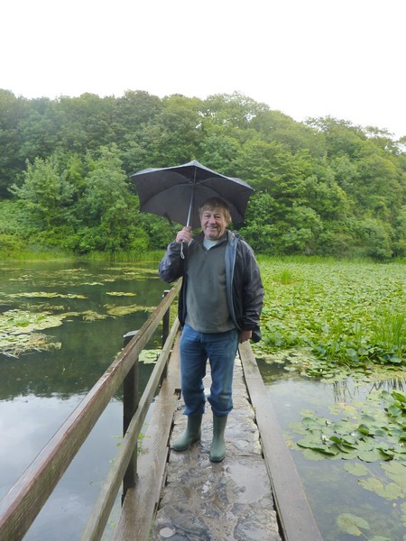
It was still raining when we walked out to the lily ponds – but in February 1985, when we had visited before – the water of the ponds and little cascades was frozen hard into spectacular ice formations.
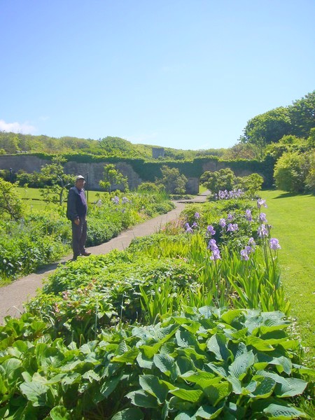
It was after 10 o’clock when we left, but on reaching the ‘main‘ road I saw a sign to Stackpole Mencap Gardens, which I had wanted to visit, so we turned off there. These walled gardens are used for mentally handicapped people to be shown how to grow things. We enjoyed the sweet peas. Some produce is for sale, and we bought runner beans and courgettes.
It rained again heavily as we left, and drove on through the village of Stackpole, turning off to Stackpole Quay. The road here was better than we’d imagined, but when we reached the quay, we couldn’t get through two parked vehicles, and had to wait for one driver to return.
It was still raining when we pulled into the National Trust car park (we have saved this year’s fee by the car parks that we have used!), so we had coffee and a Welsh cake, and by then there was blue sky. We had a short walk across to the narrow pebbly quay, with a small harbour wall at the end. A group of divers were just getting into the water. We didn’t attempt the 15 minute walk to sandy Barafund Bay.
Adrian at sandy West Angle Bay
Equally lovely Freshwater West

St. Govan's Chapel, Bosherston
Broad Haven South
February 1985
Bosherston Lily Ponds July 2011
We now drove on to Freshwater East, and from the disabled parking area walked onto the wide sandy beach, with a stream flowing into it. We remembered the children playing in this in the past.
Stackpole Quay
We drove through Freshwater East, finding that the roads had changed since our 1972 map! We drove back to the main road, and then on small roads to Manorbier. We parked overlooking the bay, and had our lunch. A few surfers were in the water when we arrived, and many more joined them, but they spent the whole time lying in the water, waiting for the right surf, looking like a group of black gnats! It wouldn’t suit me! An immense grey castle overlooked the bay.
Freshwater East
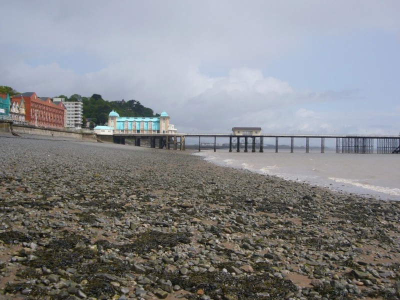
Now it was on to Tenby - a lovely town, as we remembered, but too difficult for us! It was extremely busy, and parking was impossible. There were a few disabled parking spaces near the walled arch into the old town, but not enough for us! We had a quick glimpse of the sandy beach, and then headed for Saundersfoot. This too was busy and touristy, and the flowers were even more amazing than Tenby. We could see the lovely sandy beach, and just north of the town were able to pull in above Coppet Hall beach, and walk onto the sand.
Manorbier Castle
We now took small roads to Wiseman’s Bridge, where cars were parked above the beach, but not many people were on it – perhaps they were all in the pub! Having no room for us, we continued to Amroth, a pleasant little place, with a line of pretty houses opposite the pebbly beach, which was sandy further on.
We continued to Pendine with its 6 mile long sandy beach, and had to walk onto it, remembering past visits, but it was very draughty! We called into a small convenience store for some milk, but there was very little selection of anything else.
Coppet Hall Beach
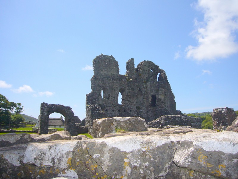
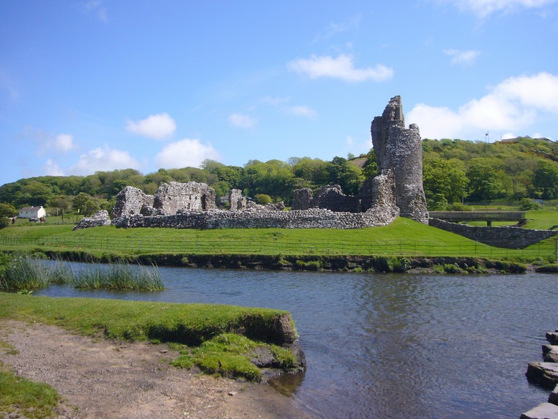
Now it was on to Laugharne, with its atmospheric castle beside the estuary of the River Taf. We parked overlooking the grassy marsh area, and enjoyed an ice cream before walking along by the castle. We had visited Dylan Thomas’ ‘Boat House’ (where he did much of his writing) before, so just glimpsed it from afar. We thought the small town very pretty as we drove on through to St. Clears.
Pendine July 2011
On frozen Pendine beach, Feb 1985
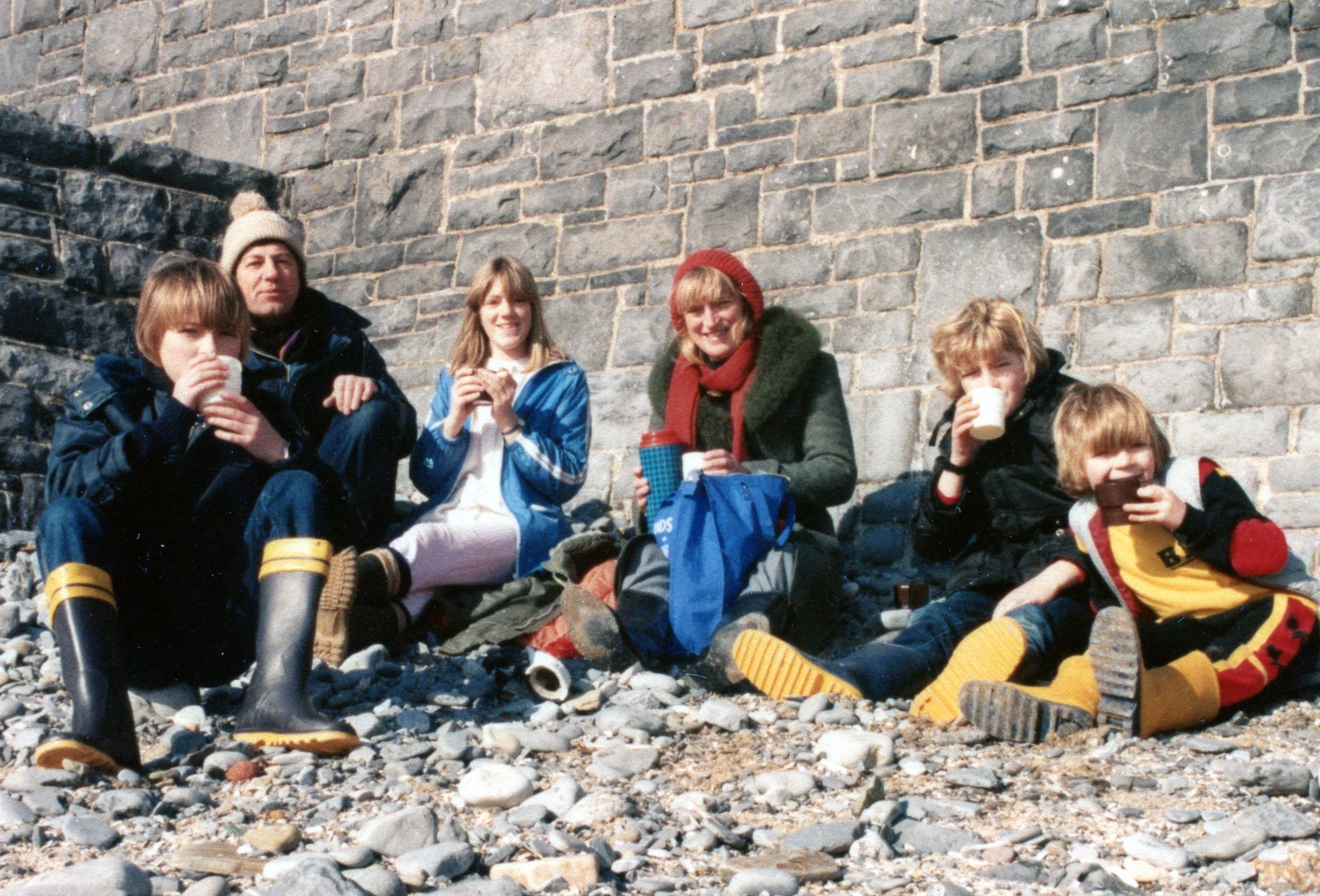
Family picnic lunch, Pendine beach, Feb 1985
We had to take a circuitous route on small roads to get to Llanstephan, on the banks of another estuary, the River Tywi. It is overlooked by a castle once again and in front of the little line of pretty houses is a grassy area known as The Green. It would have been a lovely place to stop – shame about the ‘No overnighting’ signs!
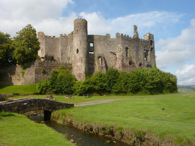
Laugharne Castle
We walked across the grass to the sandy beach – it was pleasant and peaceful. Calamity struck as we tried to leave. As we passed a badly parked car, Adrian realised that the step was still out. It became embedded in the bank, and wouldn’t move! Adrian edged back a little to release the step, and drove onto the grass, where he was able to temporarily push it back. How he has cursed the fact that the light to say that the step is still out is hidden from his view when driving.
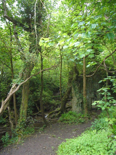
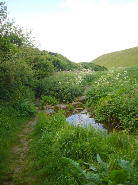
We took the unpromising road towards Carmarthen, looking for somewhere to overnight. We were not at all hopeful, but shortly before the town, we came to a small parking area for Green Castle Woods. We pulled in and decided it was OK. The wooded area, owned by the Woodland Trust, had several walks, mostly used by dog owners. While Adrian busied himself getting the step to work again, I set off on a short walk, very reminiscent of many in USA, through a small bit of ancient woodland beside a tiny stream.
Llanstephan
Saturday 9th July 55 miles
We had a short walk through the beautiful damp forest before leaving at 8.50.
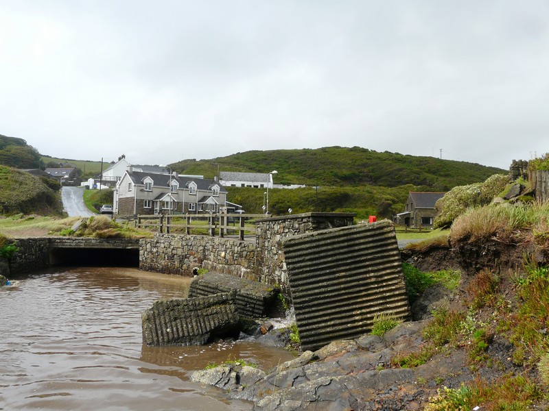
We realize in preparing this section for the website, some of the places were not given maximum coverage, but this diary was never meant for the website and we have been to this area many times in the past so if it was difficult we 'passed' them by.
It was pretty looking down to the attractive River Tywi (Towy) as we drove up to Carmarthen. Having crossed the river, we turned south again, soon turning off the A484 onto a small road nearer to the river. This was OK, but the next road we turned off on to was more challenging – very narrow, with high stone walls covered in vegetation – very unforgiving!
We reached Ferryside, on the opposite bank of the Towy to Llanstephan. The village, backed by hills, is long and drawn out, but the location by the water is really pretty and peaceful. We heard a curlew, with its evocative cry, as we walked onto the sandy beach.
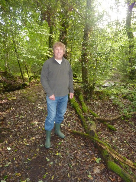
Our walk in Green Castle Woods
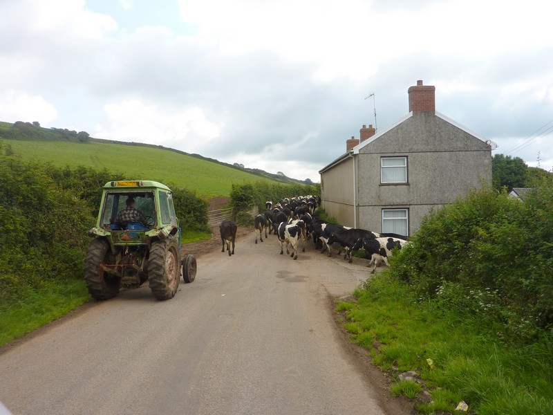
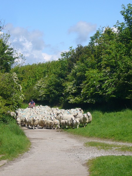
As we continued following a rural road beside the water towards Kidwelly, we had to wait while a chap on a tractor shepherded about 200 cows from a field to walk down the road. We followed very slowly behind them, noticing that the cows at the rear weren’t walking well. Progress was extremely slow, and just before we finally stopped at the entrance to the field the cows were entering, the chap got out of the tractor, and another man, who had arrived in a car from the other direction, swapped places with him, the tractor still running slowly forward! The former tractor driver then got into the car and drove off!
We drove beside the River Towy at Ferryside
At Kidwelly, we turned off to Kidwelly Quay, having to wait several minutes at the level crossing. We were surprised at the Quay to find that the whole area had been recently developed, with freshly laid gravel roads and paths, picnic seats, and a grassy area. We had thought it such a remote place, on the Gwendraeth estuary, which might have been a good place for our tea and Welsh cakes! In fact it was once again really peaceful, with black headed gulls, wagtails and swallows, and yet another curlew on the water’s edge. We looked across the mudflats and the estuary, and could make out the farm which the cows had come from, and the tractor and the cows themselves in the field.
Welsh traffic jam!
We drove back through Kidwelly, where preparations were being made for a fair, with the fire engine being used for the men to put up the bunting.
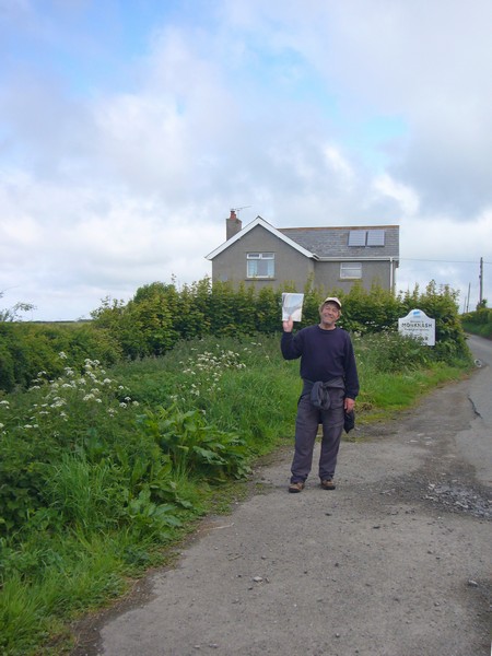
Our next stop was Pembrey, and the reason that we wanted to stop here was that Dad Cape had worked here as a lad, when his father had been foreman at the munitions factory which stood here. The whole area has long been a country park (with an entrance fee), and we had to decide whether or not to go in there. We pulled into a parking area and read some of dad’s autobiography, when he had come first for a holiday with his mother. We knew that we had to go into the park, although we wouldn’t be staying long. The man at the gate had said that there was a visitors centre. What he didn’t say was that there had been a much larger visitors centre which had been knocked down a few years ago, and most of the stuff is in storage. There is at the moment just a small prefabricated hut, most of which is a gift shop, with a few leaflets. We bought a miniscule brochure on the munitions factory, but while in there, a gentleman standing at the counter, when he heard of our interest, told us many facts about the former works here. Almost everything had been removed, but there are still tunnel entrances to be seen.
We walked briefly on to the sandy, but again windy, beach, where some sort of ‘challenge’ must have just ended, as there were groups of young people in their tracksuits. The park seems well used, with lots of people coming to walk, cycle or picnic on this fine Saturday.
We returned to have lunch in the van, with me feeling a bit fragile, as a result of the medication on my stomach! We read through more of dad’s autobiography, when he was actually working here as a young lad. He mentioned the Kidwelly Fair, which is what we presume we saw the preparations for.
It was 2.15 when we left, annoyed that the viewpoint, which would have given us an overview of the whole area, had a height barrier on it. Driving on through Pembrey, we tried to see the house that dad might have lived in, but it was too difficult to know which it might have been.
We drove on through Burry Port, where dad sometimes went on a Saturday night. We were pleasantly surprised to find a lovely sandy beach by the harbour, with views across to the Gower peninsula. We walked on to the beach – once again it was sunny but windy!
Very wet ground!
As we drove on through Llanelli, we could see very little evidence of its former industry. We stopped and walked across sand dunes towards the beach, enjoying the views, but not the wind!.
Now we crossed the River Lougher towards Swansea, turning off to the Gower Peninsular, but the roads were very different from on our ancient map! At Gowerton, we looked across vast salt marshes to the north. We pulled off by a creek in the mudflats at Pen-clawdd before taking a small narrow road across the salt flats, where people used to go cockling.
Sandy Burryport
Boats in the mud at Pen-clawdd
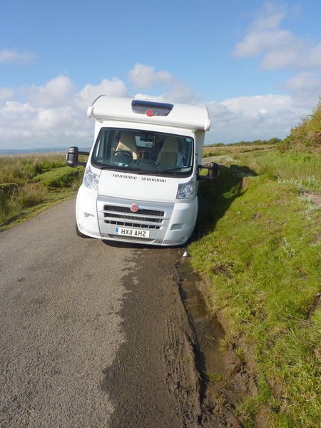
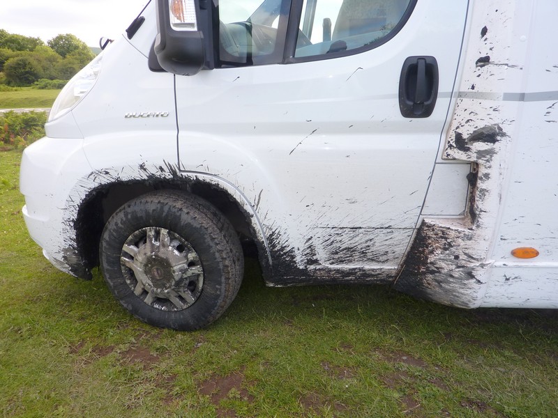
There were sheep and a few cows grazing. We were nearing the end of this rural road when disaster! In pulling over to pass another car, the van got stuck good and proper in the soft verge! What to do?
The other driver came back, and the few passing walkers all tried to be helpful, but Adrian knew that we would need towing out. He tried phoning our breakdown service. After hours of waiting to be answered, he was negotiating with the receptionist, who thought that non mechanical breakdowns weren’t covered, when the money on the phone ran out!
Adrian thought that the best bet was for him to walk on to the nearby village and get help. Luckily a reversing motorist gave him a lift, and he stopped at the pub, where the locals came to his aid and phoned a local young farm chap. He them came along in his landrover, but after much discussion and trials, said that he would be better to pull the van from behind. This entailed him driving back and round in a loop to arrive at the back of us. Then – success – he pulled us out really quickly. Profuse thanks, and then more thanks at the pub when we passed it, and at 5.40 we were on our way again!
We still drove on small roads, past Weobley Castle, where there was a concert tonight, so more cars about – we were feeling very wary! We reached Llanmadoc, in the NW of the Gower, but didn’t want to take any more ‘iffy’ roads!
We took the road south across Ryer’s Down, where there was room for us to pull off for the night, and enjoy the rural view while Adrian got things sorted out!
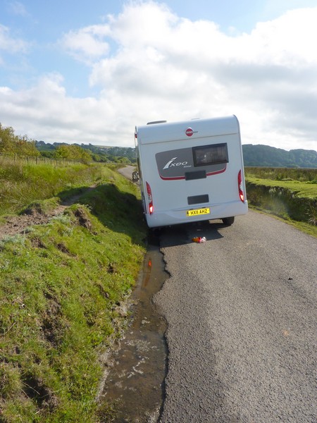
"Don't pull over that's a ditch not a verge"
"I told you so"
"You'll have to clean the van!"
Sunday 10th July 179 miles
We left at 7.30 on a fine morning, hoping to find somewhere soon to stop for breakfast. In fact it was almost an hour later that we were able to stop!
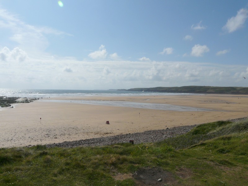
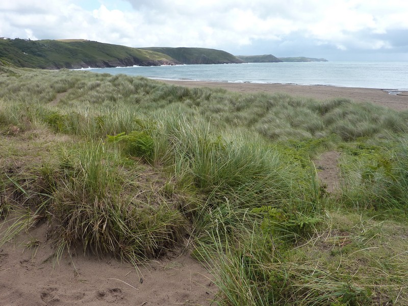
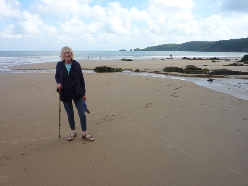
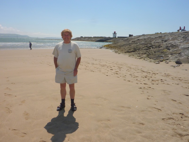
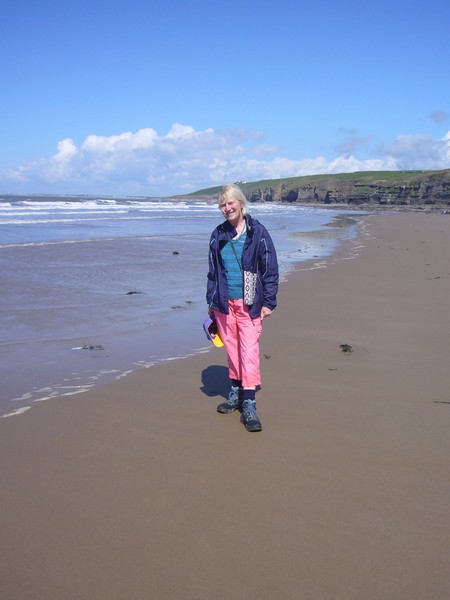
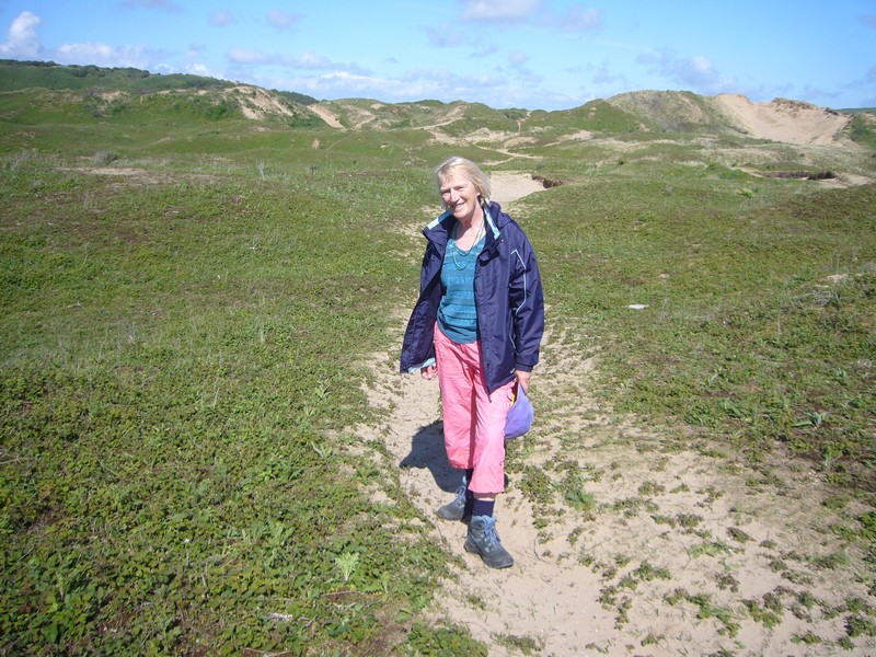
We had driven first through Llangennith to Hillend, at the western end of the Gower, but this just ended at a campsite. We drove back, and took roads of varying width to Rhossili, on the south western corner of the Gower, but the car park here cost £5, so we just got a glimpse of the lovely sandy beach before returning east and down to Port Eynon. We had seen several caravan parks marked on the map, so hadn’t been expecting anything, but as well as a car park, there was disabled parking just above the lovely sandy cove. After breakfast, we lazed on the beach in the warm sunshine for a few minutes – the first time since the first day! Being Sunday, it was already getting busy by the time we left.
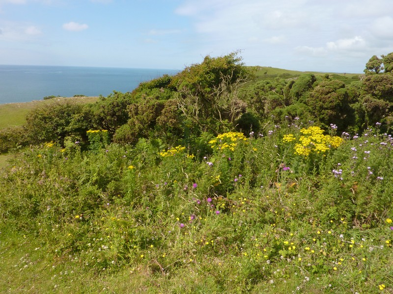
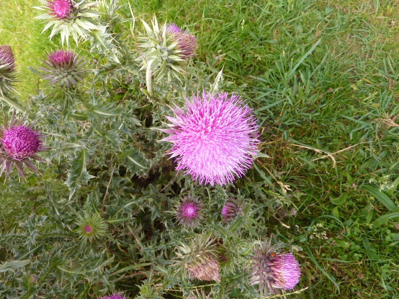
We drove along roads of varying width to Oxwich, which we think we have visited before. We had to drive along a very narrow road through the village, but the car park here was fee paying and had a height barrier so we couldn’t/didn’t stop, but continued to the A418, turning off to Southgate. We could see a parking symbol on the map, and joked about what it might be like. Adrian said that what we’d really like was a National Trust car park with a view. What a surprise to drive through the suburban looking village of Southgate, to end up above Pennard Common at a National Trust car park! There were views down over the grassy common scattered with ferns and bushes to the wonderful cliff scenery. After a short walk, enjoying the colourful yellow ragwort and purple thistles, and the lack of wind, we sat on a seat for our cup of tea and Welsh cake.
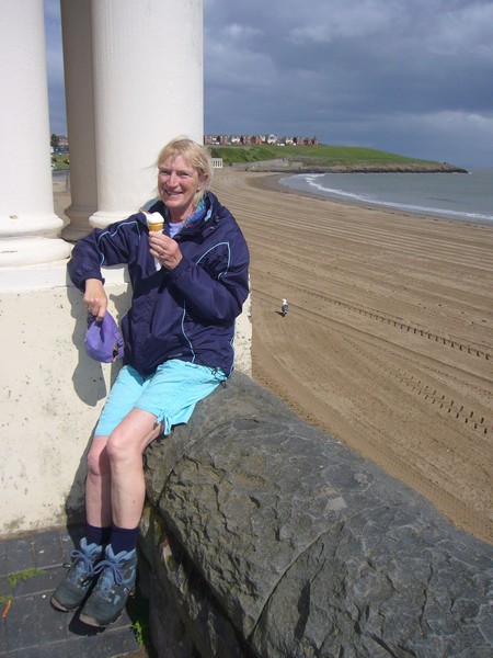
Enjoying sandy Port Eynon beach
We drove on to Caswell Bay, a pretty, sandy cove, popular as a surfing beach. We pulled into the car park, where the chatty young Harry Secombe attendant let us stop without paying when we said that we had a disabled permit, and would only be a few minutes. He tried to be very obliging, and said that if we went to the little shop in Kittle (which we had already driven through) and told them of the silly git at Caswell, they would give us a discount on a burger or a pair of shorts or whatever! He said that he had a much better map than our OS one, and returned with a leaflet with a diagrammatic plan of the whole Gower! We walked across onto the windy, sandy beach, where families were enjoying themselves, and a group of children damming a stream reminded us of our kids in the past.
Pennard Common
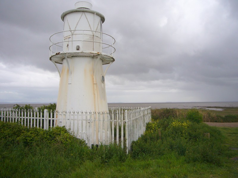
We continued to Mumbles, via Langland Bay, where the access to the car park was too difficult for our vehicle, and parked long enough to view and photograph the lighthouse.
Let's dam the stream! Caswell Bay
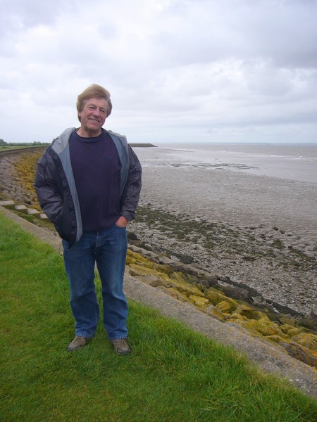
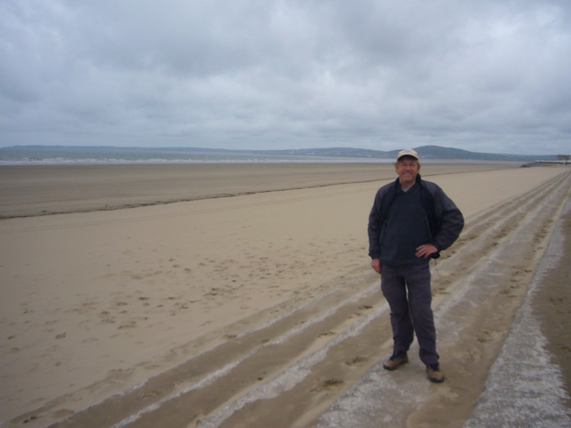
We were now nearing Swansea, with no obvious places to stop. We pulled into a parking area at Mumbles, with views back to the lighthouse, and on to Swansea Bay, paying the 50p while we ate beans on toast for lunch in readiness for our journey home. It had been a great week away.
Looking to the Mumbles lighthouse
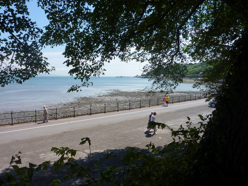
We drove on past Swansea, enjoying the fact that the road went right along beside the front, with a large grassy area with trees and the prom to the side. Being a beautiful Sunday afternoon, there were lots of people about, especially as there was an ‘Event’ going on, but we didn’t find out what!
We had a good journey home on the M4, almost thwarted at the last moment, when we passed the scene of an accident which had just happened a couple of miles before we turned off at J13. Several cars were involved, one of which was facing the wrong direction, in the middle of the carriageway, but nobody appeared to be hurt, so we drove on by.
We reached home at 4.20, where the garden looked pretty, but it didn’t seem to have rained at all while we’d been away.
Lunch stop at Swansea before the drive home

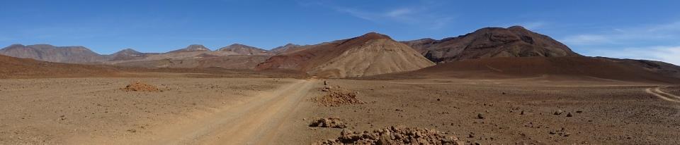
Road Round Britain continues with Port Talbot to the Welsh Border at Magor - which unfortunately goes the 'wrong way'
Monday 18th May, 2009 95 miles
As we were planning to meet up at Ed & Liz’s house in Abergavenny for a family weekend, we decided to do a bit of the Welsh coast first.
We left just after midday on a rather unsettled day. There had been high winds and heavy showers for several days, and today was no different!
We stopped to have lunch at Leigh Delamere services, as we have done on many previous occasions, and then headed for the Severn Bridge.
We had wondered whether to cross on the older bridge, a bit further upstream, but decided that the ‘coast’ started at the M4 bridge. The weather became particularly inclement as we crossed, paying our ₤5.40 toll, but unable to see anything much of the Severn Estuary, partly because of the poor visibility, and partly because of the bridge railings.
We turned off to Magor to start this bit of the coast. It seemed a pleasant little village, with a stone war memorial contrasting with the gaudily painted yellow Chinese takeaway!
Beside the church were the ruins of the 16th Century Procurator’s House. We stopped to have a look. It was just 3 o’clock, and happy children were making their way home from school, despite the impending rain.
Half a mile back along the road was the village of Undy, which we had thought a good place to start, but on returning there, we had trouble in finding the road down towards the estuary. It was difficult to find our way with just the road atlas.
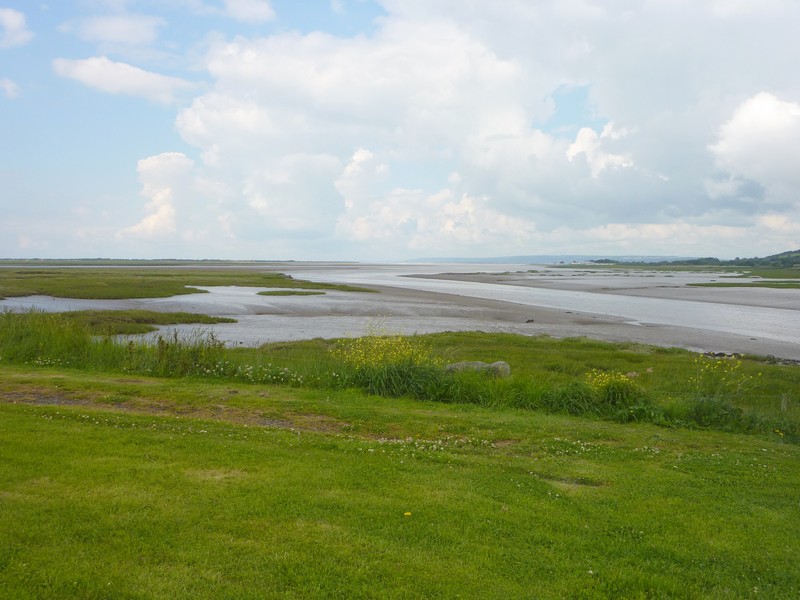
Once we’d found the right road, we drove through rural, flat, green country, called ‘Little Holland’ in our ancient coast book, to the small village of Goldcliff, and an area by the Bristol Channel known as ‘Seawall’. We were able to park here, right by the grass covered ‘sea wall’, and have a short, blowy walk along the dyke, looking across the murky estuary.
The Procurators House, Magor - the tithe collector in 16th century
Sheep and their young lambs were frolicking on the slopes.
We drove on to Uskmouth, where a large power station dominates everything. Just before it though, we had driven past Newport Wetlands, an RSPB site, so pulled in to the car park. In the Visitors Centre we were given a map, and proceeded to walk out to East Usk Lighthouse, making a circular trip back to the car park. I would have preferred it to be warmer and less windy, but we had a bracing walk, and viewed quite a lot of birds – coots, tufted ducks, grebes and house martins. From the lighthouse, we could look across the estuary to north Somerset, with Steepholm standing out prominently.
Adrian at 'Seawall', Goldcliff
We hurried back, as the next rain shower was chasing us.
We drove back the mile or so to Nash, where Adrian had spied a pull-off beside the road, which we pulled in to at 5 o’clock.
We enjoyed sushi with a glass of wine, and later ate some crisps and cheese. We hadn’t fancied the smell of the chicken we had with us, so put it on the roof for the night, with a note to remove it in the morning!
East Usk Lighthouse
Tuesday 19th May Past Newport, Cardiff and Barry 59 miles
The morning was very unsettled as we left just after 8.30am. We managed to find our way to the transporter bridge, although the roads had been much changed since our atlas map! The bridge was now closed, but looked quite magnificent with its turquoise-blue painted fence and little cab, like a seaside hut. A group of ‘travellers’ had settled themselves just before the bridge. They were well settled in with smart caravans, one with plants outside, a portable loo, dogs in kennels and children’s toys. Nobody was about on this wet and miserable morning, but we spent some time walking around the bridge entrance. There was a sign telling of other transporter bridges in the world. There are about 20 – Middlesbrough, as we knew; Duluth, which we visited last year in USA, and Buenos Aires, which we saw this year, being some of them.
We drove on into Newport, which seemed to be an attractive town, even on this dismal day. Much was pedestrianised, and we would like to have looked around. It was surprisingly quiet for ‘rush hour’. There was a mixture of old and new, with ruins of a castle right near the centre, and close to some ultra-modern buildings.
We drove to the western end of the transporter bridge, where more signs told about the bridge. It had been opened in 1906, mostly to give access to the steel works on the other side. After renovation, it had been reopened by Claire Short in 1995. We don’t know how long it has been closed.
We drove on round and out of Newport, taking the smaller road near the coast. At St Brides we drove right down to the sea, stopping in the car park adjacent to a caravan park. It was very wet as we dashed up the sea wall to view the Severn estuary with a beach of miles of patterned mud. Uskmouth Power Station was in the far distance.
It was beautifully rural as we drove on through Peterstone towards Cardiff, with fields of buttercups on either side of the road.
The weather brightened as we reached Cardiff. We drove past some smart industrial estates and dock areas, including ‘Cardiff Bay’, which we imagined might be the old ‘Tiger Bay’. It was all a bit too busy for us to stop, so we continued over large bridges towards Penarth.
We turned off to ‘Penarth Haven’, but this was just a smart area of posy apartments with a marina, and continual speed humps. We managed to drive on to Penarth itself - an attractive town, which we drove right through until we came to the seafront. Here we were lucky enough to find a place to park.
The sun was now shining, so we sat on a seat overlooking the beach, but as we discovered, it was still really windy!
Adrian had managed to get an internet connection, and on looking at the weather forecast, stated that “there won’t be any more rain today’.
We had just stepped out of the van to walk along the ‘prom’, when rain started! Nevertheless, we walked along the pebbly beach towards the pier, looking across to Steepholm and Flatholm. We thought that we’d walk onto the pier, but, having walked a short way down one side, the rain became a sudden torrent! We retreated back to the pier entrance, where a tiny tourist information was open. We picked up a few leaflets, while we waited for the rain to subside, and Adrian lashed out and bought an Ordnance Survey map of the next section (not the one we are on at the moment).
Newport transporter bridge
It was now fine again, so we walked back to the Tiv via ‘Windsor Gardens’, several flights of steps above the road.
A bit further on we stopped again to walk the ‘Cliff Walk’, which went south towards Lavernock Point. It was fine as we set off, but we walked too far, because the rain returned as we were making our way back to the Tiv! We arrived back drenched!
After a pleasant lunch, we listened to a bit of recording that we had made with Mum Cape, realizing that we had very little detail of her time of living in South Wales.
We now took a small road to St Mary’s Well, stopping when the road did by small St. Lawrence's Church. We found what we had come to see though – a plaque stating that near this point, the first radio transmission over water had been made by Marconi in 1897, to Flatholm. A narrow path led from here down to the beach, but after our recent soaking, we didn’t attempt it!
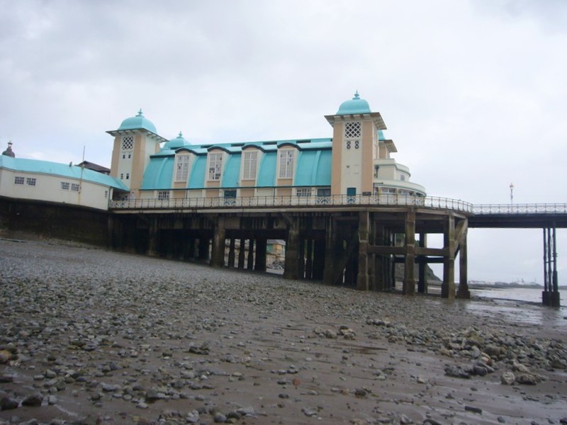
Penarth Pier
Another road led off soon afterwards, but this one didn’t go through either. Instead, after a long winding and narrow drive through tall trees, we arrived at a couple of pleasant houses with wisteria and rugosa roses at Swanbridge. There was a view across to Sully Island, which can be reached at low tide, and has evidence of prehistoric living. We drove the long way back, and then found the other end of the road – a large lorry blocked the road as we entered it, so we had to reverse. It was only a short distance to the end of the road this way, but we just got to the carpark of another holiday park, and a restaurant called the Captain’s Wife. The area was lovely, with different views to Steepholm and Flatholm, but the caravan parks were worse than Ladram! Had the tide been right, we would like to have walked to the island, but instead, we just continued to Barry.
There was very little activity in the dock area of Barry, which had grown from a tiny place to a huge port in the 1890’s, when Barry Island had been joined to the mainland by a causeway, and they started to build the docks. We had a short walk in the former dock area, opposite the island, and then drove on to the Island itself. This was a pleasant surprise!
Today it was very quiet, and now the sun was shining again. The Pleasure Park (closed) looked really small and unimposing, and if the Holiday Camp is still there, we didn’t see it. We walked on to the wide beach at Whitmore Bay of fine sand, which had just been raked, ready for the ‘season’. We stopped to buy an icecream, while seagulls and pigeons made havoc of a dustbin sack of rubbish.
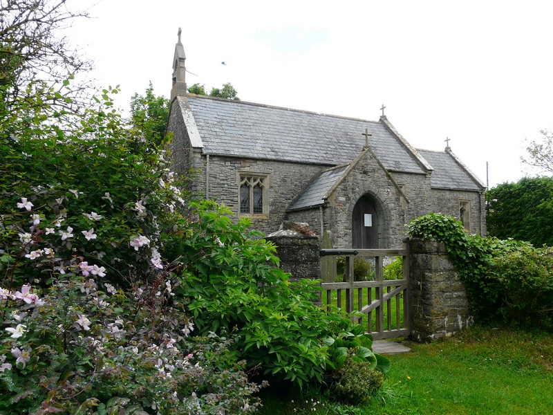
The pretty church at Laverstock where Marconi made his transmission to Flatholm
Having enjoyed our icecream, we walked on to a headland, which had been the site of the first hotel here. In peak summer it might all look different, but today it was all really nice.
We now drove past the old harbour to Cold Knap Point, where we parked opposite a pebbly beach, and walked out briefly in the wind. Just on from here was Porthkerry Country Park. We had seen that there was a high railway viaduct here, but didn’t know how to access it. We drove into the park, on a long road with speed humps through lovely wooded country. Eventually we stopped at a car park, and discovered that the beach was a short walk in one direction, and the viaduct was up behind us!
So – we had a lovely walk to the beach – which was just a stone’s throw from the one at The Knapp! – and enjoyed looking up to the great viaduct. Yellow irises were flowering by the stream, and it was lovely. We drove back out of the park – no through route – and were now onto our Ordnance Survey map. Hooray!
We turned off to drive around Cardiff Airport, taking another road which went back into the park from this side, ending by a hotel, but where Adrian stopped to photograph the viaduct again. As we reached the road by the airport, a plane had just landed, and was edging slowly along ahead of us, a few feet above us on the runway!
We had commented on a man cycling with a ‘chariot’ behind, like Simon’s when in the park before. We passed him again now – and saw that he had 2 small dogs, not a child!
We made one more short drive into the park, stopping by pretty Porthkerry Church, before continuing on round the airport and through the town of Rhoose. We had been wondering where we might find to stop for tonight, when at 5.45, we came to an unpretentious layby at Font-y-gary, and pulled in.
Wednesday 20th May We enjoy the lovely Heritage coast – until a calamity! 19 miles
We woke at 7.30 to a much brighter morning. We left at 8.45 and drove on to Limpert Bay, a parking area right by Aberthaw Power station. We saw that this would have made a really good overnighter.
We set off to walk along the beach of very large stones, which made the going difficult. We found our way on to the grassy footpath behind the beach, where we were treated to lots of birds – stonechats in particular, and we could hear larks.
Whitmore Bay on Barry Island
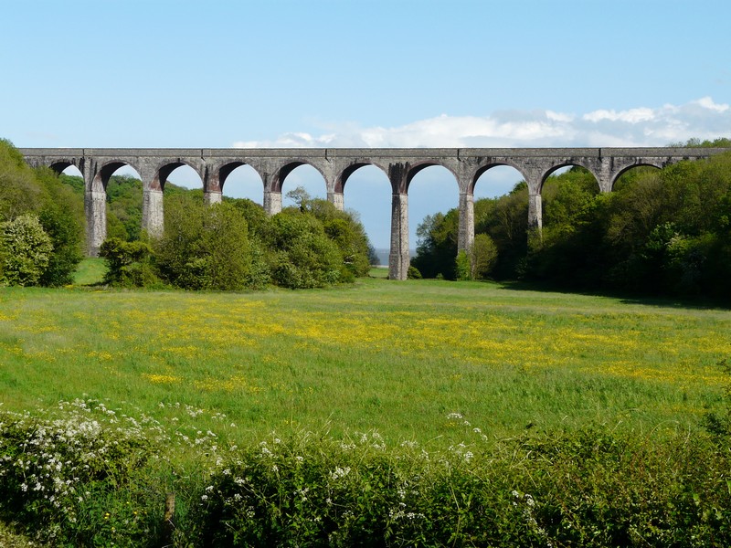
The railway viaduct in Porthkerry Country Park
We looked across to Minehead across the estuary, and could see the white roofs of ‘Summerland’ there, looking like clouds.
Around one of the concrete boulders there were sobering memorials to an 18 year old boy who had died last September. We wondered how he had died.
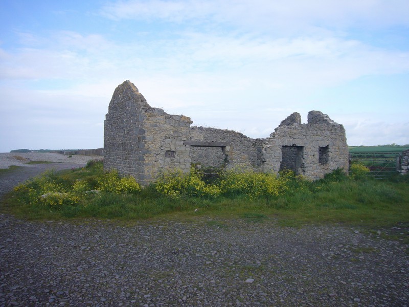
We now drove on through Boverton, finding our way down a small road, which became a really pot-holed track, which we drove a long way along until we stopped at the ‘car park’ to visit the ‘Seawatch centre’. From here we had a long walk through pretty woods on an often muddy path, until we finally reached a tiny coastguard station, high above the sea. After all this, it didn’t open until 12.00 today, and now it was 10.15. We walked along a bit to get a view out over the channel, and enjoyed the birds as we walked back, particularly the chiffchaff, whose call we recognised, and then we actually saw the bird.
Derelict house at Limpert Bay
We retraced our steps back to Boverton, and on through Llantwit Major, an attractive little town, which seemed busy, particularly as there were road works. We took a road with many speed humps, which then followed a long , narrow track to the sea at Col-huw Point.
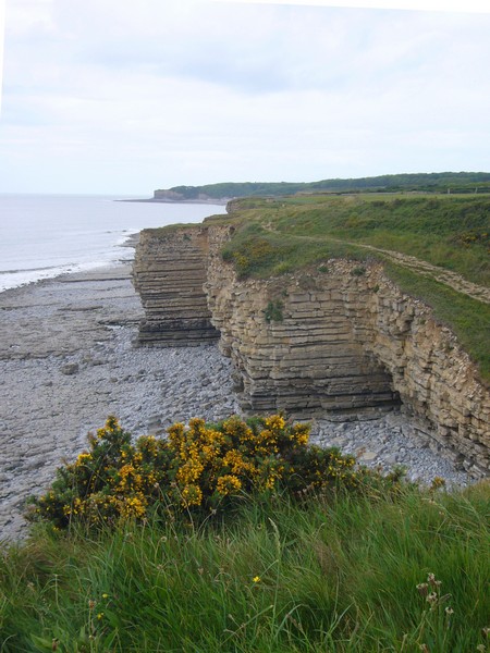
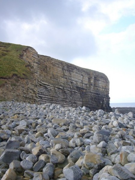
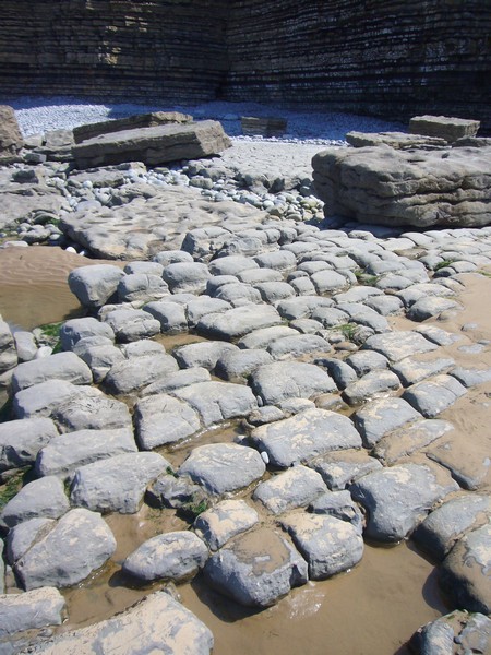
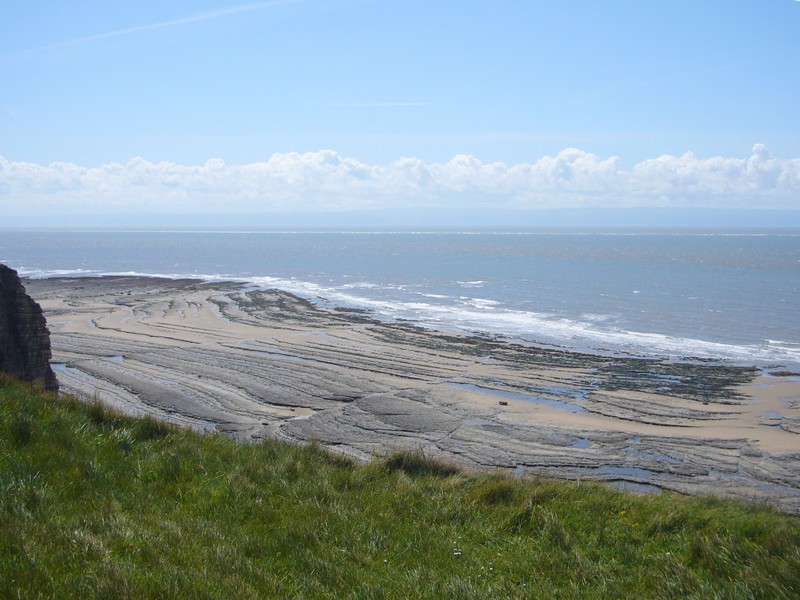
There was a car park here, so we pulled in, and sat on a low wall looking out to sea. We then set off on a walk along the top of the cliffs, past Tresilian Bay to St Donat’s Bay. Set back from here is a castle, now a sixth form college, but formerly owned by American tycoon Hearst. It was a lovely walk, in calm, mild weather. We enjoyed the views across the estuary, and the birds. Sea thrift was growing amongst the grass and rocks. The limestone cliffs here form horizontal layers, and the beach is often a ‘pavement’, looking like a jig-saw puzzle, with its broken rocks.
Just before reaching St Donat’s, we climbed down to the rocky beach, where we saw lots of fossils amongst the rocks.
The land at St Donat’s was private, so we ascended the cliffs again and began our return walk. We had come unprepared, without even water, so were glad that the weather wasn’t too hot.
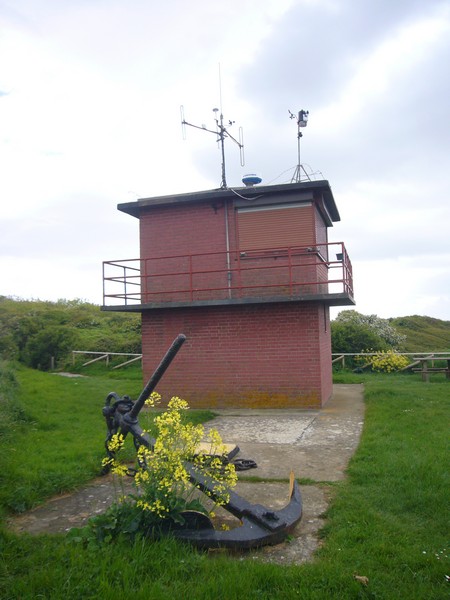
The Seawatch Centre
It was 1.10 when we reached the Tiv. We set about organising lunch. On our walk back, we had passed a group of girl students on the beach. A second group had been on the beach in front of the Tiv, and were now eating their lunch, sitting on the low wall. There was still room for us, and we were pleasantly surprised to see how well behaved these young girls were. Each group of 20 was in the charge of one male teacher. They appeared to be 6th formers, and Adrian thought from a private school, as they were so well mannered and compliant. I noticed that every one of them had long hair.
It was about 2.30 when we set off back up the long track – but then disaster struck! There was a sudden large bang, and Adrian realised that the clutch cable had broken! He said that he could keep on driving, but once he stopped, we wouldn’t be able to start again!
Precariously we soldiered on, over all the speed humps, and back through the little town of Llantwit Major. Luckily there was very little traffic. We took the small road on to St Donat’s, where we knew that there was no parking. We came to a small group of young cyclists, one with a pillion passenger, but luckily passed them without incident. At Marcross, we continued over the crossroads, madly seeking somewhere to pull off the road. Finally, just as we came to the sign saying ‘Monknash’, there was a small layby, so we pulled in.
Now we had to think what to do. Adrian searched for information on our breakdown policy, but having found it, we saw that our mobile phone didn’t log in. He remembered a second phone which we had , but that didn’t log in either. There was a house just ahead of us, but there was nobody in. We prepared to walk on into the small village, but then saw that there was a house just back along the road. We made our way there – it was a smart house in a lovely situation, and I noticed that there was washing hanging in the garden. Adrian knocked on the large wooden door, and it was opened by a small woman holding a little boy. She welcomed us in, and offered us her phone. While Adrian tried to get help, I chatted to her and her delightful little blue eyed boy Gryf, who was 20 months old. She also had a little girl of five, who was at school.
We declined her repeated offer of a cup of tea, and Adrian finally got through to the breakdown people, and we left this lovely home.
Back at the Tiv we had a long wait for someone to come.
Our walk along to St Donat's bay, showing limestone cliffs and pavement and St Donat's castle, now a Sixth Form College
After an hour and a half, Adrian tried phoning again – this time the phone logged in. Still we waited, and it was nearly 6 o’clock before the man arrived. Adrian was surprised to see that it was an RAC man – we had thought that it would be a breakdown truck, wanting to tow us somewhere (but we didn’t know where), so we were really relieved. The lovely young chap knew just what he was doing, and Adrian enjoyed chatting to him as he set about repairing the cable. By the time he had finished it was nearly 7o’clock, but we had the van mended – something we couldn’t have imagined earlier.
We felt that we had outstayed our welcome in this small layby, so drove on a short way, turning down towards Cwm Nash, where we had a car park marked on our map. This turned out to be a field, with a sign saying ₤2, but we pulled in, and I quickly cooked supper, as we looked back to the lighthouse at Nash Point, and the Somerset coast beyond.
View while we were waiting
Thursday 21st May Along to Porthcawl 30 miles
There was a blue sky with fluffy clouds when we woke up, and we were surprised to see that the half dozen or so cars parked in the field last night had all gone. When we left for our walk at 8.10, a cloud had come up, and we had a shower of rain. We planned to walk to Nash Point, but to do this, we had to first carry on down the narrow track and then continue through Cwm Nash, a lovely wooded valley which was a nature reserve. We passed the ruins of an old mill. When we reached the coast, we climbed up on to the grassy hills, and then it was just us and the skylarks. A little way off shore was a lifebuoy with a ringing bell – it sounded just like a church.
Just before the lighthouse (in fact there are two), we made our way down to the beach – a gap in this superb section of high cliffs.


Friday 22nd May To Port Talbot
The day started grey and windy. As Adrian went to pay the lady, her two tiny identical twin grand daughters looked on – each with curly brown hair, white flowery tops and brown trousers. They made me think of the twins in ‘My Naughty little sister’, when she thought that one was a reflection of the other.
We drove the short distance to Kenfig Reserve, but it was a disappointing visit. The visitors centre wasn’t yet open – we saw the shaven headed ranger in his shorts as we walked around. There was no leaflet on the place, which circled a pond, with Margam steelworks beyond, and continued through sand dunes to the beach. We had no intention of doing that walk today, so made our way to the pond, where we saw no bird life at all. We did see and hear songbirds on our different route back, but the other visitors here all just seemed to have come to walk their dogs. When we heard a lady with badly dyed red hair saying ‘come on baby; oh sorry my darling’ to her wretched little dog, we knew that it was time to leave!
We now followed a route behind the steelworks to Port Talbot. We found our way through the uninspiring outer parts until we reached a fine sandy beach beside the harbour, just beyond the steel works. The tide was far out, so it was a long walk across the sand to the waters edge.
We stopped a bit further along the 3 mile stretch of sand, at Aberavon beach. Here we made our last trek across the wide beach to the sea, with the Port Talbot steelworks in one direction, and Swansea and the Mumbles in the other.
Aberdulais Tin Works
We now had to decide whether to return the same way, or walk up through the valley, and then along the road. We opted for the latter. We had already commented on the meandering stream, and now we had evidence of it – we crossed it on stepping stones several times. Flowers abounded – yellow buttercups, white cowparsley, a few bluebells, and some really deep red campion, with a smattering of herb robert. It was quite delightful, but then we came to a section where the path hardly existed, so resorted to finding our way by road. Firstly we walked through the small village of Marcross, and then along the road we had been parked at yesterday afternoon, before taking the lane town to the farm where the Tiv was. There was virtually no traffic, and we got back soon after 10 o’clock.
Our walk to Nash Point
We drove on now through St Brides Major to Southerndown and Dunraven. This was a most beautiful spot – a huge sandy beach backed by the stunning layered cliffs. We walked down on to the beach, amused at a large group of infant children who ran races on the beach before setting off to explore. The only other people were a young dad and his little boy who were fishing ‘for crabs’. We walked right along the beach, enjoying looking up to the magnificent layered cliffs. On the beach, rocks lay in sections like a cobbled street.
We now made our way through a stone gateway, following a roadway up to a superb walled garden. This must have been part of the Dunraven estate, but we saw no evidence of a house now. Having walked through the large garden, we emerged from the other end, and met Ted, aged 86, with his little dog Mabel. During the next 15 minutes, we had heard much of Ted’s life history. He lived in Cardiff, but had a son in Southerntown, and also a daughter in USA. He drove down every day, and walked here. He loved the open air, despaired of city life, but was proud to say that he still had his own teeth and hair, and was really happy with life. He had started work aged 14 at a nursery, where he, and others, had had to double dig a field. While we were talking, a beeping of a car horn signalled the approach of a load of sheep with their lambs. They were being shepherded by a chap on ATV, with a truck following. “I knew it,” said Ted, “when he came to open the gate. Clever how the sheep know where to go, otherwise they’d go over the cliff”. We eventually said our goodbyes, and found a path back over the cliffs. The views were fantastic, and it had been a lovely visit.
We drove on now, crossing the River Ogmore at Ewenny, and driving down to the tiny little village of Merthyr Mawr. We drove on to park in the car park of the nature reserve of Merthyr Mawr dunes. From here we walked for half an hour across the dunes, finally reaching the beach, where the wind was so strong, that we didn’t stay long! There was just one couple with their dog!
The dunes were a delight with the abundance of flowers – white roses with tiny leaves, hawthorn bushes, and all sorts of miniscule flowers – weeny pansies, speedwell, buttercups, and strawberry flowers. We were glad that there were signs indicating the way to go through the dunes, or we might still be there!
We now drove on to Ogmore on Sea – a small town where the River Ogmore reaches the sea. This is the end of the wonderful cliff section of the coast. After lunch of tuna sandwiches, we walked out on the fabulous sandy beach, scattered with rocks. It was sunny, but really windy.
We stopped again beside the River Ogmore, at a really tranquil spot with sheep and swans. A bit further on we stopped again by the evocative ruins of Ogmore Castle. There were stepping stones across the river here, so after having a look at the castle, we walked across them and back again.
Now we were nearing Porthcawl, so braved the first real town for several days, and came down to the beach beside the enormous static caravan park – our 1970’s book says 3000 vans, the largest in Europe. We saw very little of it, and the beaches are lovely. This first stop was at the far end of the dune beach. One or two children were in swimsuits, and I even put my feet in the water! We couldn’t see much of Trecco Bay and Sandy Bay, both of which are in front of the site. We drove on through the town of Porthcawl, which looked pleasant enough, with a delightful little harbour. We drove on to Rest Bay on the western side, and thought how like seaside towns of Kent and the south coast it seemed. The tide was in now, so we saw no sand at Rest Bay, and made our way just out of town to a Camping Club Certificated Site, arriving at about 5.45. Several horses and a cow came to say hello as we enjoyed the sunshine, but the strong wind kept us inside.
Walk at Merthyr Mawr
This was the end of this part of our ‘Road around Britain’, which we had really enjoyed, despite the unsettled weather and the mishap with the clutch.
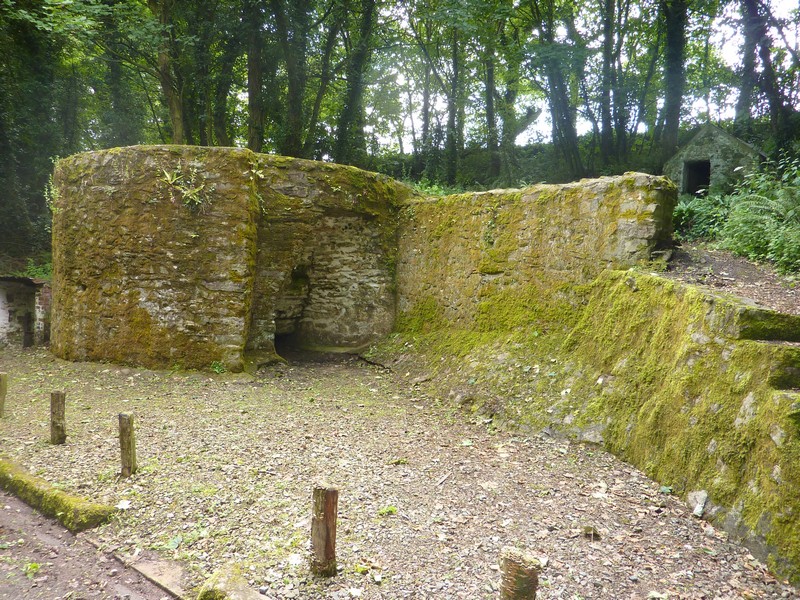
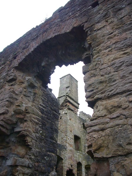
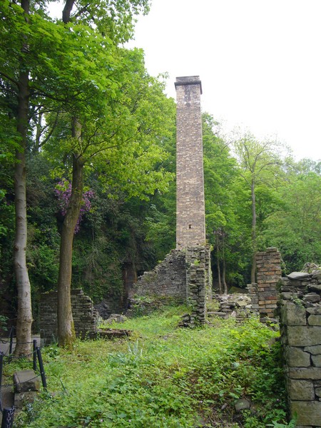
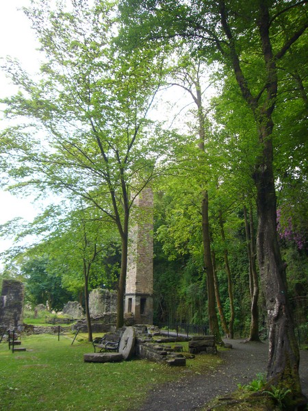
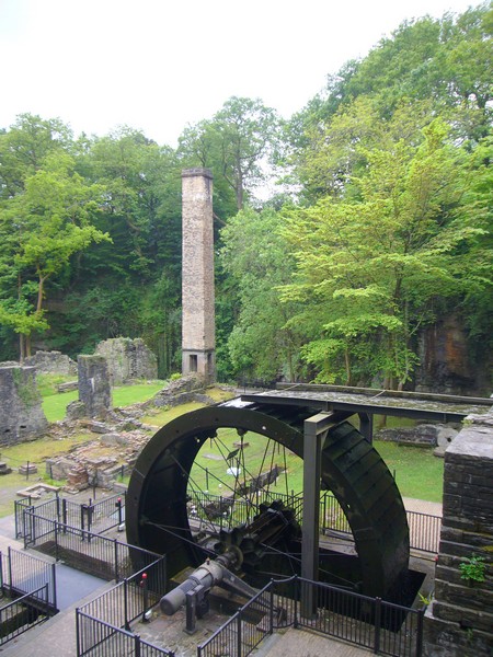
We drove on through Neath, where we shopped in Morrisons, overlooked by the ruins of Neath castle, and then visited Aberdulais Falls, a National Trust property on the site of a past tin works, before continuing to our family weekend at Ed & Liz’s.
Aberavon Beach - Steelworks one direction, Mumbles the other
Walking back to Marcross
Our walk around Dunraven
Walking by the River Ogmore
The next section is Southwest England